Showing posts with label connecticut river. Show all posts

Sunday, March 25, 2012

Charter Oak Bridge, Hartford-East Hartford, CT

Charter Oak Bridge
It doesn't carry as much traffic as the Bulkeley Bridge, and it isn't the city centerpiece that Founders Bridge is, but the Charter Oak Bridge, the third (and newest) of Hartford's bridges across the Connecticut, has its own reasons to shine.

The Charter Oak that gave its name to the Hartford neighborhood where this bridge lands is a tree of legend in Connecticut. In 1662, the story goes, King James II decided that the colonies had had quite enough of this independence thing and appointed a governor, Edmund Andros, over the newly created Dominion of New England. When he arrived in Hartford to revoke Connecticut's charter, he was shown it, and then the candles blew out. When relit, the charter was gone -- hidden, it was said, in a huge oak tree, the Charter Oak, in south Hartford. In 1689, Andros was deposed and the Dominion of New England dissolved.

The original Charter Oak was split by lightning 150 years later, but its descendants live on, and the wood of the original tree was made into a chair which stands now in the State House.

Connecticut has always prided itself on its independence -- it was the first state to ratify the Constitution. The Charter Oak is Connecticut's symbol.

Charter Oak Bridge from the tour ship landing
The East Hartford side of the bridge stands in a small park which is (unfortunately) rather marshy. The Hartford side ends in Charter Oak Landing, the main dock for boats both personal and commercial in Hartford.  The Lady Katherine river tours leave from here. (The boat used to leave from Riverside Park near Founders Bridge, dunno why they moved down here). The public landing is on the south end of the park; the north end gives magnificent views of of the Colt Park section of Hartford (marked by the colorful dome on the old Colt Firearms factory) and of the Hartford skyline.

Charter Oak Landing
This picture may have been processed a little bit. I was having some fun with the new version of Picasa. You can see the Colt factory dome on the left of the photo.

Obligatory car shot
I don't honestly know how to get to the park in East Hartford. I've only been there on my bike, and I got there from the bridge itself, which features a wide, separated bike path on the north side. Charter Oak Bridge carries routes 5 and 15 over the river; following those signs will get you there. Or just click on the location information beneath this post and use Google Maps to get you there.

I've gotten to the end of this post without talking much about the bridge itself. You can see from the pictures that it's not all that special, a very modern girder bridge built with steel and concrete, similar to the East Windsor river crossing. It was built between 1988 and 1991 to replace an earlier bridge at the same point. Anyone going from I-84W to I-91S will cross the bridge and will never see the beautiful parks beneath it.

Friday, March 2, 2012

Bulkeley Bridge, East Hartford-Hartford, CT

Bulkeley Bridge from Great River Park, East Hartford
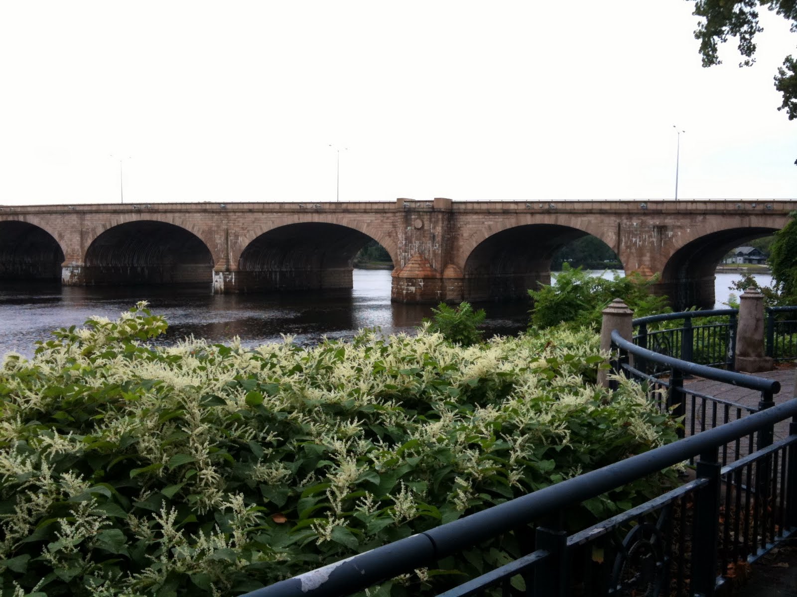
I have to accept that I never will take the "perfect" picture of Bulkeley Bridge. This bridge is made from thousands of shaped stones, and I believe is the longest stone arch bridge in the world. It carries I-84 over the Connecticut River between Hartford and East Hartford. There's a pedestrian walkway along the south side of the bridge, just recently repaired. The bridge condition was getting pretty dire.


It's not easy to get a good sense for how massive this bridge is from pictures alone. You have to get close enough to see all the individual carved stones that make up the bridge and just try to imagine the work that must have gone into each one. They fit together perfectly. I took the top picture last weekend with my DSLR camera; I took the one just above this paragraph a couple years ago with a Samsung point and shoot.


This one I took last summer, after Hurricane Irene decimated the forests that line the Connecticut River and the debris was left to drift downstream, to fetch up against the Bulkeley. You can see just how high the river had risen after the storm.


This is the very first picture I took of the bridge. I'd been driving on top of it for a couple of years, but had never stopped to see what the bridge actually looked like. The stone of the bridge changes character with the light.

The Bulkeley Bridge is the center of river recreation in both cities; the parks on both sides are filled with sculptures, paths, boat landings and such. An "after Independence Day" celebration takes place on the Hartford side each year; sometimes they put colored lights under the arches and light them at night (haven't managed to catch that in advance, yet).


A view of the north side of the bridge, from Riverside Park. Done with really faky HDR before I knew what I was doing. The first picture in this posting is also HDR, but in the year or so since I took this picture, I've figured out about balancing the exposure levels between the composite shots and stuff. Doesn't mean the picture is any good, but at least everything is the correct hue and luminance. Some people have figured out how to do crazy HDR that looks totally unearthly. I don't necessarily WANT to do that -- those photographs tend to be so noisy I can barely figure out what the picture is of -- but I'd like to have that tool in my toolbox to make my pictures look more abstract.

Anyway. Plenty of parking on both sides of the bridge, though on the Hartford side you're more likely to be made to pay. I don't remember if you have to pay to park in the boathouse parking lot.

If you ever come to Hartford, take time out to visit the Bulkeley Bridge. Come when there's something going on and make a day of it. When Hartford puts its mind to it, it's a really nice city.

Saturday, February 25, 2012

Memorial Bridge, Springfield-West Springfield, MA

Springfield

A couple months ago, I photographed some bridges up in Holyoke. On the way back, I thought I'd get some pictures of the South End/Buxton Bridge, a bridge I'd never photographed before. I was snapping shots along the way and as I got to the far end of the bridge, saw that I could get a good bit of the Memorial Bridge in the shot. I fell in love with that sky and promised myself I'd go back after I got my new camera.

The shot above was taken with my old camera, the Canon G12.


Today was supposed to be clear, but instead was cloudy and windy. I hoped for as good a picture as the top one. The sky grew more overcast as I drove north (Springfield isn't that far away, but apparently far enough). When I got to Springfield, there were even flurries in the air. The puffy clouds were gone.

Still, I'd driven all that way. I parked in the Pynchon Point parking lot in Agawam, took some pics of the Buxton Bridge from the ground, climbed to bridge level and walked to where I'd taken the first picture. It took a few minutes to get the tripod and camera set up -- and then the clouds to the south broke, illuminating Springfield and the Memorial Bridge.

I got the shot.

This is the point where the Westfield River flows into the Connecticut River. I wrote about the Great River Bridges a couple of days ago -- they cross the Westfield River in Westfield.

Wednesday, February 22, 2012

Bulkeley Bridge & the Elephant, Hartford, CT

What IS that?
I keep mentioning the Bulkeley Bridge but haven't posted any pictures of it because there's more pictures I want to take before I do a "real" post. But there it is in the picture above. Cross it every day. I am blessed.

I took that picture about a year ago on my phone. Last year was really snowy and a lot colder -- the river is frozen over in this picture -- but this one day, it was warm, in the 40s, so I got on the bike and came to work through the snow and slush.

I stopped by Riverside Park to get some pictures of the frozen river and Founders Bridge and Bulkeley Bridge. On my way to the Bulkeley Bridge, I passed this sculpture. I was totally intrigued by it. I have NO IDEA what it is. It's unsigned, untitled, a total mystery. It's not on the website for the park. I see it in the background of other people's photos so I know it's been there for a few years...


When spring came, I took another picture of it, with my bike.


I took to visiting it through the year.


Whenever I felt stressed out, I'd stop by Elephant (as I named it).


So if you know anything about this sculpture, let me know?

Saturday, February 18, 2012

East Haddam Swing Bridge, East Haddam-Haddam, CT

East Haddam Swing Bridge
The cruise on the Connecticut this morning was all I'd hoped it would be. The weather was cold, but clear; the river was quiet, and the eagles were out. We saw many bald eagles perched in trees, a flock of eagles wheeling around in the sky, owls, swans, cormorants, ducks, gulls, crows, ravens... I even saw a turkey vulture on the way home.

The East Haddam Bridge was built between 1911 and 1913. The west half of the bridge is an anchored truss bridge. The east, swing half of the bridge is a steel deck reverse truss bridge that puts all its weight on the pivot instead of the edges.


This unique swing method put so much stress on the pivot that it had to be shored up with further construction to keep the bridge safe. The builders did so without destroying the essential character of the bridge.


There's plenty of parking on both sides of the bridge. On the East Haddam side is the Goodspeed Opera House, the Goodspeed Airport behind it, the town offices and a fancy restaurant. The river boats leave from Eagle Landing on the Haddam side of the bridge; even in the depth of winter, the cruises are popular. There were crowds waiting for their boats all the time I was there, and ours debarked again, full of new passengers, minutes after we ourselves landed.


I regret that I didn't have a longer lens to take better pictures of the birds. I've put a link to the album with the birds in it below.

The East Haddam Swing Bridge is the southernmost freshwater bridge over the Connecticut. By the time the river gets to the mouth crossing at Old Saybrook, Long Island Sound's effluence has turned the river salty. Conversely, the Connecticut is largely responsible for keeping Long Island Sound from being as salty as the Atlantic.

While it's legal to walk over the bridge, there's no sidewalk or marked lane. You'll be dodging cars. A bicyclist crossed at speed, though. He was pretty brave -- I wouldn't trust my tires on the steel mesh deck of the swing portion.


Eagle Watching

Friday, February 17, 2012

Willimansett Bridge, Holyoke-Chicopee, MA


So excited! It looks like tomorrow's Connecticut River Cruise is a go! It's going to be in the morning, but not early enough to get some dramatic sunrise on the river pictures. Those will wait until it's warmer.

Anyway. Today's bridge is the Willimansett Bridge in Holyoke, Massachusetts, just north of Springfield, where I was going for more shots of the Memorial Bridge. Springfield's Memorial Bridge, like Hartford's Bulkeley Bridge, will get a post when my photography gets good enough to do it justice. Practice!

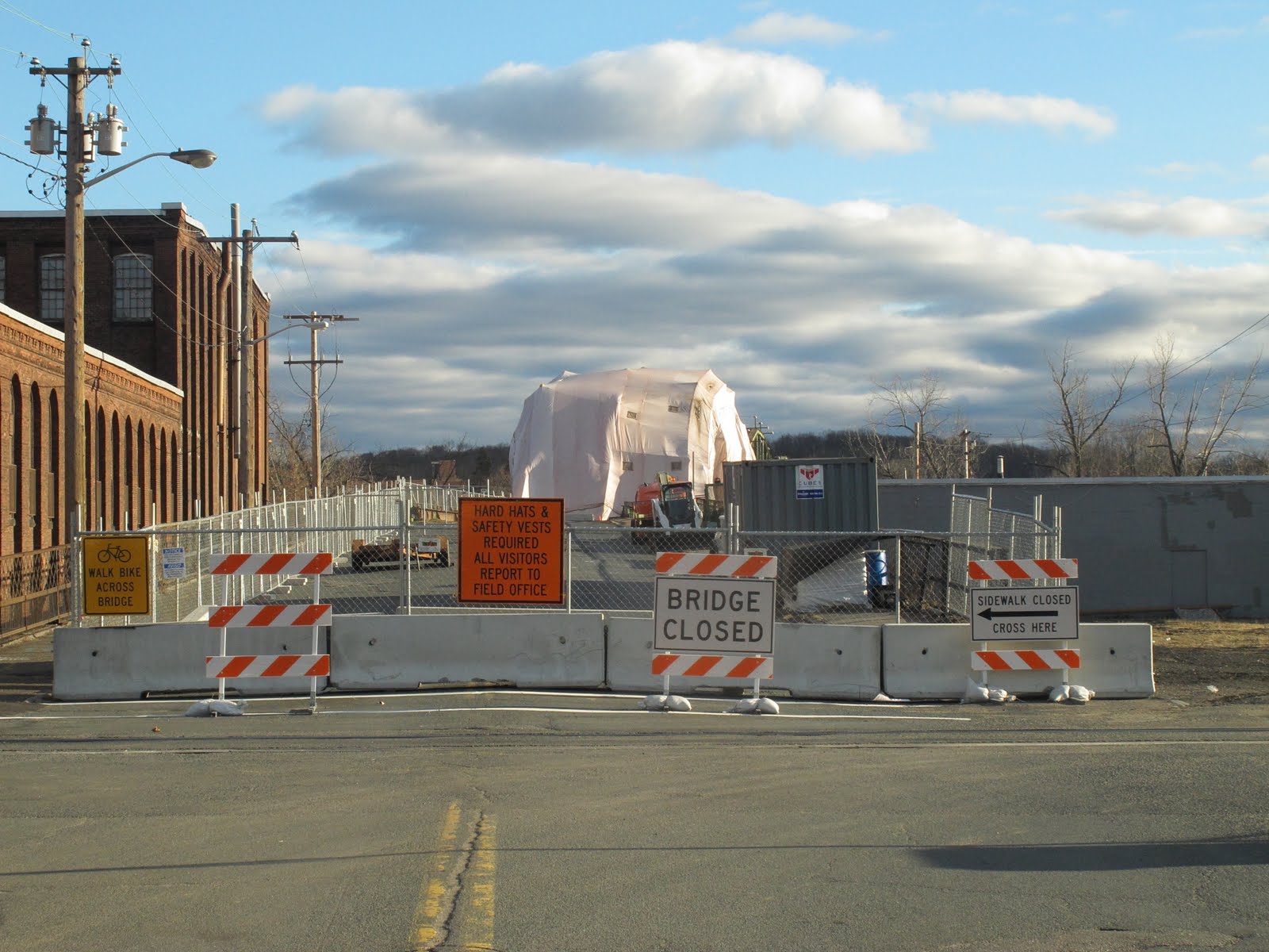
The Willimansett Bridge is a four span truss bridge over the Connecticut River. Built in 1891, this old bridge is currently closed to traffic while it undergoes an expensive renovation. Over 15,000 cars are said to have crossed this daily when it was open, which is frankly astonishing. Now drivers have to go a couple miles downriver to take Route 391 across.

The Route 391 bridge is boring, but it is definitely the best vantage from which to see the Willimansett Bridge -- but only at highway speeds from your car, as there is no pedestrian access on that bridge. There is, however, pedestrian access on the Willimansett.

It looks as if you could probably climb down the north bank on the Chicopee side of the bridge and get a better view, but by this time I was already quite a long way from my car and getting nervous about it, as I'd accidentally left my phone on the front seat.


Holyoke has a canal running alongside the Connecticut which is crossed by several other bridges. The Water Street bridge, above, crosses one outlet of the canal as it heads to a dam and into the river. You can see a bridge crossing the dam itself in the background.


This short, three span arch bridge takes Cabot Street over the canal and up to the Willimansett Bridge. With the canal crossed by all these low bridges, I'm not sure what the function of the canal IS. Maybe irrigation?


The Willimansett Bridge in the background, covered by tarp while workers work inside it. Pedestrian access is to the left.


On the Willimansett. I still had my camera with the bad lens at this point, and my phone with its excellent camera was (as mentioned above) back in the car, so I couldn't take pictures that looked toward the west (or the bridge), where the sun was shining, without having the image ruined by huge flaws. Gotta get that fixed, because the G12 is a really good camera and it cost me a lot of money. Even broken, it takes these fantastic pictures with incredible color.

Truss bridges aren't particularly rare around here, but every one is unique, all of them beautiful, and most of them were the lifeblood of their communities. I can only imagine how proud the people who lived in Holyoke were of their bridge when it was built 121 years ago.

Willimansett Bridge ca 1893

Tuesday, January 24, 2012

Bridge Picture of the Day: Founders Bridge, East Hartford-Hartford, CT


I can't figure out the weather this winter. Today it was like March. In January. No way I wasn't going to bike into work today.

While crossing the Bulkeley Bridge, I saw ice which had been crawling toward the middle of the river last week, retreating toward the banks today. In the background is Founders Bridge, that takes Route 2 from East Hartford to Hartford and has one of the nicest pedestrian/bike walkways in the area. Great River Park on the East Hartford side looks across the Connecticut to Riverside Park in Hartford. Both are rich with sculptures and places to sit and watch the Connecticut roll by.

I'm saving the Hartford area bridges for huge posts later on. I use them every day and I want to give them the coverage they deserve. They might peek into pictures now and then.

2012 Eagle Cruise -- East Haddam Swing Bridge


I have a lot of pictures of the East Haddam Swing Bridge to show, but I'm holding off until February 12th. That's the day I'm taking a cruise down the river with CT RiverQuest looking for eagles on the nest. It's bird watching, sure, but -- EAGLES! Bald eagles! On the Connecticut River! And it starts right here in East Haddam!

So there's sure to be even cooler pictures of the bridge and the river and the sights around it. I'm writing about bridges I have already been to now -- and I have a lot of great bridges yet to write about, including the extremely historic bridge I cross every day -- but the intention when I started this blog was to go out, photograph a bridge, then come back and share the best of the pictures here, same day. They've just been sitting (until now) in my online photo albums where there's really very little room to write about them.

As much as I love bridges, I love my bicycle and my car as much. I've wanted a Supra for decades. And my bike -- I had a Trek when I lived in California and saved my pennies until I could get one here in Connecticut as well.

Getting my car and/or bike in the picture with the bridge is kind of a thing with me. The Supra against the swing bridge -- I really like this picture.

Anyway, look for more about this bridge -- and any eagles we manage to see -- in February.

Monday, January 16, 2012

Charles J. Arrigoni Bridge, Portland-Middletown, CT

The Charles J. Arrigoni bridge takes routes 66 and 17 across the Connecticut River between Portland and Middletown.

The plaque bolted to the bridge at the center point says that it was opened to traffic August 6, 1938. Honorable Wilbur L. Cross, Governor.

She doesn't look bad for a 74 year old lady. I think this might be the most beautiful bridge that crosses the Connecticut in this state. The Bulkeley might be more historic, and the East Haddam bridge more mechanical, but neither beats the smooth sinuosity of the Arrigoni.

I first crossed it on the way back from a visit to Gillette's Castle. I'd just gotten a car after being restricted to bicycle for two years. That's a story for another time. Anyway, I'm coming up route 9 and there's the bridge! And there it went. I had my grandson with me and we were heading back home for my own birthday party so I didn't stop then.

It was raining when I went back, a light mist. I parked on Main Street and headed over the bridge on the pedestrian walkway. The eastbound lane was (and is as of last Saturday) closed for construction, so the shot I really wanted, of the Providence & Worcester Railroad swing bridge just south of the Arrigoni, I couldn't get. North of the bridge, an island separates the Connecticut in two for awhile. The east bank is the terminus for oil tankers and was off limits. The west bank looked residential.

That would be the best place for a picture of the bridge. If I could figure out how to GET there. See, there is no direct connection between the Middletown downtown area and the residential area I needed to get to. But if you drive up 9 a bit, then come back down on the south lane, there's a hard-to-see sudden turn to the right that crosses some train tracks and there you are.

Way too close to the base of the bridge. I crossed over to the Portland side of the bridge and passed the oil towers and came to a really nice park built to commemorate Portland's famed brownstone quarries. The island in the middle of the Connecticut hid the bridge from easy view (and plus, it was raining so visibility was low to begin with).

The shot up above was out the passenger's window as I was driving back to Middletown from Portland. I parked at some state offices south of the Portland side and got some pictures beneath the bridge and of the P&W swing bridge.


I was coming back up route 9 from photographing the East Haddam Swing Bridge and was wondering if there were any roads on hills I could park on and get a better broadside shot of both the Arrigoni and the railroad bridge.

I didn't find any of those, but I did notice, going past, that there was a riverside park that should have great views of the bridge. And it did.

It's a little tricky to get to, so I've embedded a map to the spot. I'm not a hundred percent happy with the shot. The way the railroad bridge is positioned, it looks like it might be some sort of support structure for the Arrigoni. It's not. It's not even that close to the bridge.

When I go back -- there's some smaller footbridges in the area that I want to shoot -- I'm hoping the eastbound lane and pedestrian walkway will have opened.

I would love to get on that island.

Update: According to an article in the Middletown Press, the construction will be shifting to the middle two lanes of the Arrigoni at the end of January. February would be a good chance to get a picture of the railroad bridge from the Arrigoni.

More pictures!