Showing posts with label massachusetts. Show all posts

Wednesday, March 19, 2014

Sagamore Bridge, Bourne Bridge and Cape Cod Canal Railroad Bridge, Cape Cod, MA

Sagamore Bridge, Bourne, MA
It's been a year since my last post... this is a gap too long. I've still been taking bridge pics, just -- not posting, for some reason. I dunno. New bridges mean driving further and further... still worth doing, but now they require a bit of planning to get to.

Spring has finally come to New England after a horribly long winter. I've been wanting to hunt the bridges that cross the Cape Cod Canal for a long time, but it's always been either too cold, or too filled with tourists. These bridges are a huge bottleneck for people traveling to and from the cape. The roads from Bourne to Provincetown are narrow and slow. There might be just a couple of weekends left before the antique shops re-open and the cars start to pile up. This was my chance to get these bridges before it was too late for another year.

Buzzards Bay Railroad Bridge, and OMG MY CAR!!!
The Cape Cod Canal is a seven mile canal formed by connecting and widening two rivers that allow shipping to and from further down the East coast to get to Boston-area ports without having to round the cape. The Wikipedia mentions that George Washington once surveyed a potential path for the canal... building on work the Pilgrims had begun a hundred years earlier. This canal, though, is only about a hundred years old.

The Sagamore Bridge on the north end of the canal, and the Bourne Bridge near the southern end, are both steel arch bridges with suspended roadways. They carry a substantial number of cars each day, but during summer, the lines of cars waiting to cross can reach miles long. This is why many residents opt to use the Cape Cod Canal Tunnel to skip the crowds.

Bourne Bridge
It was pretty cloudy when I got to the cape, so I apologize for the dullness of the Bourne and railroad bridge pictures. When I got to the Sagamore Bridge on the way home from Provincetown, the day was much nicer. I probably should have gone back to Buzzards Bay and re-taken those bridge shots, but -- it had been a long day.

Long, paved trails stretch along both sides of the Cape Cod Canal, and both sides were crowded with people out for a walk, a bike ride, or roller blading. I really should have brought my bike. Behind the Bourne Bridge in the picture just above are a few wind turbines. The constant winds through the hills surrounding the canal turn the turbines and help power the Massachusetts Military Reservation. Cape Cod will also soon host the Cape Wind project, an offshore wind farm that has just last week cleared its last legal hurdle. Detractors claim the sight of turbines turning lazily on the horizon will kill the tourist trade (and unwary seabirds), but.... I have loved wind farms since I first saw the ones in Pacheco Pass and Altamont Pass back in California.

Here's a better picture of the Buzzards Bay Railroad Bridge, AKA the Cape Cod Canal Railroad Bridge, without my car in it.
Cape Cod Canal Railroad Bridge
This bridge, the southernmost bridge over the Cape Cod Canal, is a lift bridge that services the tourist trade -- a local area tourist train (the Cape Cod Central Railroad) and an express train from the Boston area (the CapeFLYER). Since I went out of season, neither train was running and the bridge stayed up the entire time I was in the area. There's enough traffic in the canal to keep boat watchers happy; while I was photographing the Sagamore Bridge, a tug pushing a barge, followed by another tug, zoomed by.
I'm disappointed in myself for taking so long to visit these wonderful bridges. Best thing about them is -- there's an entire cape of wonderful things just pass them.

Cape Cod Highlands Lighthouse, Truro

Edward Penniman House, Eastham

Pilgrim Monument, Provincetown

Town Cove, Eastham
It's not easy to miss these bridges if you're going to Cape Cod; in fact, they're impossible to avoid. All pictures were taken with a Canon G 1X point and shoot camera. I brought my Canon DSL, but I just ended up using the small camera because the pictures were coming out just as nicely.
Happy bridge hunting!

Tuesday, September 25, 2012

Braga Bridge, Fall River-Somerset, MA

Charles M. Braga Jr Bridge
My group at work changed floors; now we're located with the business folks (for whom we're the IT department), and I get to listen to the business folk talk about the business. And one mentioned the Braga Bridge.

My ears perked up, as they always do when bridges are the topic. But especially the Braga Bridge -- I knew that bridge. I had a picture of that bridge.

I got this picture on my way between two other bridges, neither of which I have written about. Because the pictures weren't great, the light was wrong... as they are with this bridge, the Braga Bridge, about which a haiku contest was run:
Six-lane thoroughfare; 
Minus two lanes of repair;
Four lanes of despair. 
Jay Martineau, Westport
I grew up not terribly far from here, and some school trip or other got us visiting the Battleship Massachusetts, which is permanently docked on the Fall River side of the bridge (you can see it there, though the battleship gray blends in so perfectly with the water and the background that it's almost like it was designed to...)

Bizarrely, I don't remember this bridge from when I was a kid. I have no explanation.

Replica of the Iwo Jima Memorial
I shot the bridge from a really beautiful park along the Taunton River just up from the bridge and just below a rather ordinary bridge that I couldn't get any sort of picture of. The park is dominated by a replica of the Iwo Jima Memorial. I had no idea it was there. I love most being surprised by the things I find when I'm bridge hunting.

Brayton Point Power Plant
Across the river from the park is the Brayton Point Power Plant, which I assumed to be nuclear, but is actually a coal powered generating station.

The Braga Bridge is much longer than I show in the picture, but it's hard to get the entire bridge in a shot, and stitching all the pictures together doesn't look cool. It's all a deck truss bridge up until this Warren truss bit on the Fall River side... so in your imagination, draw an endless line to the right. The whole bridge is over a mile long.

I was going to head down to the USS Massachusetts and try to get a more oblique shot of the bridge... but then I noticed something in the distance behind the Braga Bridge.

OMG... what bridge is THAT?
THAT... is the Mount Hope Bridge in Bristol, Rhode Island. And it instantly became the next stop on my hunt.

What was the first stop? The reason for the trip in the first place?

It was a viaduct about which Wikipedia had said was almost impossible to photograph without trespassing. I took that challenge. Someday I'll let you see how it turned out.

Tuesday, June 12, 2012

Burkeville Covered Bridge, Conway, MA

Burkeville Covered Bridge
Lots of covered bridges cater to the tourist trade. Going up Route 10 in New Hampshire, I saw lots of signs directing passers-by to the covered bridges along the way, they even had them numbered. Suggested a bicycle tour of all six.

Not this bridge. The Burkeville Covered Bridge just sits placidly in a spot, guarding the placid South River that it crosses. You'd miss if you weren't looking for it, no signs that I saw indicating it existed, even the Google Map leads you to the wrong spot (close by, but still wrong). Crawl down one country road and then another and then another and there it is -- between a farmhouse and a church, next to a machine shop, closed to car traffic by an old mill stone but still welcoming the walker.

It just is.

Burkeville Covered Bridge interior (and my car!)
The Massachusetts Covered Bridge web site shows that back in 2003, at least, the bridge was in dire shape. A plaque inside the bridge claims the bridge was built in 1871 and restored in 2005. The site linked above says it was variously built in 1951 and 1970, replacing an earlier bridge. I kinda believe that this bridge is not the same one built in 1871 -- these wooden bridges just don't last that long. Best care in the world won't make that timber not weaken after decades of traffic.

3G Construction seems to specialize in the restoration of covered bridges, by the way. They did this one and also Coombs Bridge, which I'll probably post about next.

Portal to the bridge, note millstone
Conway's annual "Festival of the Hills" features a 10K run, "The Covered Bridge Classic", that starts here.

It's a nice little bridge. If you happen to be heading toward (or from) Vermont on I-91 passing through Massachusetts, and you have a spare hour or so, it might be worth seeing. The Eunice Williams Bridge is nearby, and there's another covered bridge not far from this one that I didn't have time to go to (looked like another hour of threading narrow country roads, and this was the day I was heading to New Hamster).


You can park where I parked, on the other side of the bridge. There's a little area to pull off. I'd suggest making this bridge part of a bicycle tour, if you happened to be bicycling through the Berkshires anyway.


Saturday, June 9, 2012

The Haunted Eunice Williams Bridge, Greenfield, MA

Eunice Williams Bridge
It looks peaceful enough now -- a secluded spot by a water pumping station, a bridge crossing the placid Green River, a favorite fishing spot for the locals -- but this bridge has a history. And a ghost.

In the dark of leap day, 1704, a group of French and Indian raiders attacked the settlement of Deerfield, Massachusetts in what has become known as the Deerfield Massacre. The raiders force-marched the settlers 300 miles to Canada. Anyone who couldn't keep up was instantly killed.

That was the fate of Eunice Williams, who, having just given birth hours before, collapsed as she tried to cross the river. She was instantly killed by a tomahawk to the back of her neck while her husband, John Williams, the reverend of the town, and their children watched. The family survived the trip to Canada and were eventually allowed to return to the States. Their daughter, also named Eunice, refused to return, though, and married into the tribe of Indians that had kidnapped them.

It is said that if you drive into the bridge on a moonless night, shut off your headlights and beep once on the horn, the ghost of Eunice Williams will appear and beg for the baby that was torn from her as she lay bleeding to death in the river. Follow those links to read more about this haunted bridge.

Eunice Williams Bridge
Though actually, this bridge isn't really that old. It was built in 1974, replacing an earlier bridge. If there'd been a bridge here back in 1704 when the Indians were forcing prisoners across the river, maybe Eunice Williams would have survived.

Last year's Hurricane Irene severely damaged the bridge, knocking it off its abutments and erasing much of the near bank. It was already closed to traffic and being pounded by a storm and a torrential, overflowing river did it no favors. The town of Greenfield decided to restore the bridge. It's been placed back on the abutments (the Google Maps "satellite" view currently shows the bridge in the river, off the abutments, by the way) and the road is being reconstructed.

The bridge is closed to both car and foot traffic, but someone (not me) has bent the fence back on the other side enough so that an enterprising tourist can crawl through it.


But if you do visit, do it during the day. When the night is dark and the moon is out of the sky, who knows what ghost a chance sound might summon?


Sunday, March 11, 2012

Ware-Hardwick Covered Bridge, Ware-Hardwick, MA

Ware-Hardwick Covered Bridge
The bad thing about wooden bridges is, they're only temporary. Truth is, all bridges are temporary; even today's bridges aren't meant to last much beyond 50 years without being totally reconstructed. New England's remaining covered bridges struggle to remain aloft until there's enough money and interest to get them renovated -- or torn down entirely for the public safety.

All of Connecticut's covered bridges have been rebuilt at least once; the Comstock covered bridge down in East Hampton is only the latest. The Bulls Bridge and West Cornwall Bridge are not the bridges they once were.

Neither is the Ware-Hardwick Covered Bridge, which crosses the Ware River in (wait for it) Ware, Massachusetts. It just finished a $3 million renovation in 2010; it had been closed off for years before then, unsafe to carry any load. The original latticework and outer walls were re-used, but the floor is wood over a sturdy steel frame, and the rafters are entirely new. The roof is now made of steel, an odd choice for a historic bridge.


I found names scratched into the latticework from 1938, and I'm sure I could have found earlier if I'd looked longer. Like most covered bridges that survive to this day, it doesn't take a lot of traffic. It's not an important bridge for traveling. It's an important bridge for connecting the community to its past.

I was more than a little shocked to hear, as I was talking with some guys walking along the Ware River as I was photographing the bridge, that the bridge might be moving to a new home in Vermont. Now, I don't have a dog in this fight. Connecticut's three covered bridges are being preserved. Vermont has seen its covered bridge number drop from 500 a hundred years ago to 100 now. Clearly it would like to acquire some replacements. Massachusetts, though, only has three covered bridges -- same as Connecticut.

Obligatory car and bridge shot
After spending all this money to renovate the bridge, they are talking about selling it? Madness. I couldn't find any confirmation of this on the web; I hope rumors is all this turns out to be.

The Ware-Hardwick bridge was designed based on patent by Ithiel Town, the architect who (by wild coincidence) designed the Bulls Bridge and West Cornwall Bridge. He charged one to two dollars per foot of bridge for the use of his patent.

I'm pretty sure the Town Bridge in Canton (last week's post) wasn't named after him, but who knows?

Wooden pegs hold the lattice together

Thursday, February 23, 2012

Great River Bridge, Westfield, MA

Great River Bridge(s)
When the giant camelback truss bridge that crossed the Westfield River started getting creaky, Westfield could have just junked it and replaced it with a standard girder and concrete bridge and life would have gone on. Instead, the city doubled down, built a duplicate bridge just a bit down river, closed the old bridge and started bringing it back to code (the old bridge is foremost in the picture above; the new bridge is behind it).

The old Great River Bridge was even more worse off than was thought, requiring more years and more millions of dollars to finish the job. Westfield could have just stuck with the new bridge at that point but they decided once more to go all in, dug up part of Union Ave and turned the land between the bridges into a beautiful park. At one end, they raised a clock tower (with a REALLY LOUD chime). At the other end, they raised the existing railroad tracks to keep them usable and high enough for trucks to clear.

Park between the bridges, current railroad bridge crossing left to right in the background
Westfield's nickname is "Whip City". It used to be famous for its buggy whips. Hate to be a buggy whip maker when everyone's driving cars goes the saying, and Westfield is now just a suburb to Springfield. In colonial times, Westfield was the western-most settlement in Massachusetts. Now it's home to Pilgrim Candles, and candle shops line Elm Street.


Upriver of the Great River Bridges is an old, abandoned truss railroad bridge. There's nothing stopping anyone from walking right up to it; there's a concrete path leading right past it, actually. While I was taking pictures, a teenager skated up, picked up his skateboard and crossed the river on the bridge.

I figured this was something I'd have to try. We had a railroad bridge back in Linwood that crossed some river connecting Whitin and Linwood Ponds, and it was a rite of passage to cross it. Mind this was an active railroad (and still is, I think). Some of the boys would swing under the bridge and hide in the trusses, but it was enough for me to just cross it without falling into the river or being hit by a train. There was no reason I couldn't just skip over this one.


I couldn't do it. The ties were rounded from wear and the gaps between them wider than I expected. I could walk on those four inch beams, of course. I have been training for that my entire life. My dad and I used to walk along the tracks, and he'd walk on the rails and I'd try to do that, too. I still sometimes walk on the curbs and stuff, narrower than these beams.

I started crossing the bridge, got about halfway through the first span and with the water below me and the lack of anything to fall against (except air) on the sides... I lost my nerve and came back. I felt so ashamed of myself. Ashamed, but without any new broken bones.

You know you're getting old when...

Friday, February 17, 2012

Willimansett Bridge, Holyoke-Chicopee, MA


So excited! It looks like tomorrow's Connecticut River Cruise is a go! It's going to be in the morning, but not early enough to get some dramatic sunrise on the river pictures. Those will wait until it's warmer.

Anyway. Today's bridge is the Willimansett Bridge in Holyoke, Massachusetts, just north of Springfield, where I was going for more shots of the Memorial Bridge. Springfield's Memorial Bridge, like Hartford's Bulkeley Bridge, will get a post when my photography gets good enough to do it justice. Practice!

The Willimansett Bridge is a four span truss bridge over the Connecticut River. Built in 1891, this old bridge is currently closed to traffic while it undergoes an expensive renovation. Over 15,000 cars are said to have crossed this daily when it was open, which is frankly astonishing. Now drivers have to go a couple miles downriver to take Route 391 across.

The Route 391 bridge is boring, but it is definitely the best vantage from which to see the Willimansett Bridge -- but only at highway speeds from your car, as there is no pedestrian access on that bridge. There is, however, pedestrian access on the Willimansett.

It looks as if you could probably climb down the north bank on the Chicopee side of the bridge and get a better view, but by this time I was already quite a long way from my car and getting nervous about it, as I'd accidentally left my phone on the front seat.


Holyoke has a canal running alongside the Connecticut which is crossed by several other bridges. The Water Street bridge, above, crosses one outlet of the canal as it heads to a dam and into the river. You can see a bridge crossing the dam itself in the background.


This short, three span arch bridge takes Cabot Street over the canal and up to the Willimansett Bridge. With the canal crossed by all these low bridges, I'm not sure what the function of the canal IS. Maybe irrigation?


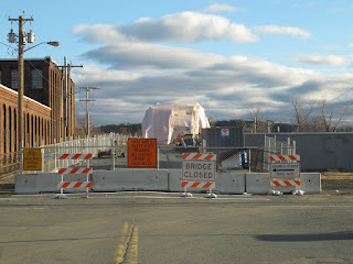
The Willimansett Bridge in the background, covered by tarp while workers work inside it. Pedestrian access is to the left.


On the Willimansett. I still had my camera with the bad lens at this point, and my phone with its excellent camera was (as mentioned above) back in the car, so I couldn't take pictures that looked toward the west (or the bridge), where the sun was shining, without having the image ruined by huge flaws. Gotta get that fixed, because the G12 is a really good camera and it cost me a lot of money. Even broken, it takes these fantastic pictures with incredible color.

Truss bridges aren't particularly rare around here, but every one is unique, all of them beautiful, and most of them were the lifeblood of their communities. I can only imagine how proud the people who lived in Holyoke were of their bridge when it was built 121 years ago.

Willimansett Bridge ca 1893