Showing posts with label covered bridge. Show all posts

Saturday, March 9, 2013

Huckleberry Hill Bridge, Avon, CT

Huckleberry Hill Bridge
It's the last snow of the season, and the time is running out to get some covered bridge pictures before the last snow. The snows we have gotten this winter have either been so light to not make the trip worthwhile, or so heavy that I couldn't drive there safely.

Come the perfect storm -- so to speak -- Friday. The heavy, wet snow had made us work from home, but the weather Saturday -- today -- would be so warm that traveling wouldn't be an issue. I only needed to find a bridge to get to before the snow melted, given I had to work in the morning.

I've found a map that collects together all the covered bridges in New England, state by state. The closest covered bridge that I haven't already been to, was this pedestrian bridge in Avon.


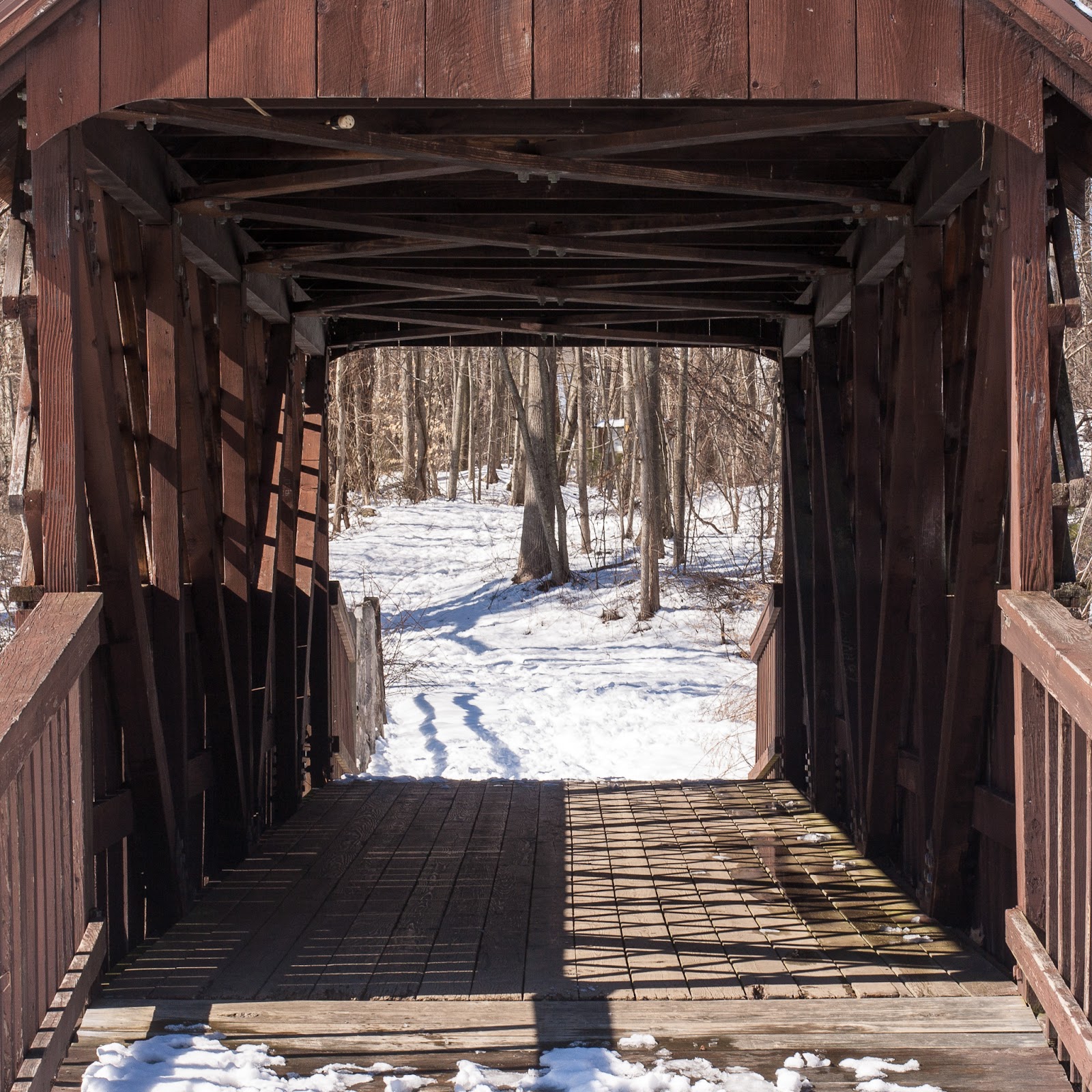
The Huckleberry Hill Bridge in Countryside Park was built in 1968 to cross the man-made pond and waterfall. At least one site claims it is a Town truss bridge, and I can see how they got that impression, because of the non-structural lattice. A look inside the portal clears it up, it's a Pratt truss bridge.


I haven't posted since September; I have some bridges on deck that I wasn't terribly happy with, but will post. This year, though -- I'm gonna abuse the heck out of that covered bridge map.

Thursday, August 2, 2012

Thompson Covered Bridge, West Swanzey, NH

West Swanzey / Thompson Covered Bridge
Sorry about the reflections. I wasn't using a lens hood and this is what happens.

The West Swanzey Covered Bridge, AKA the Thompson Bridge, was built in 1832 by Zadoc Taft for the princely sum of $523.27. Zadoc isn't a name you see every day. He's not even the most famous Zadoc Taft -- that honor goes to renowned sculptor Lorado Zadoc Taft.

Our Zadoc Taft, though, was a local boy, born, raised and died in the area. The Register of Historical Places entry for this bridge lists Taft as a master workman, but by the 1850 census, he called himself a blacksmith. Further information about Z. Taft isn't easily found; there was a Revolutionary War soldier by that name who lived in southern Massachusetts near where I grew up, apparently unrelated, and another around the same time who ran a mill in Bennington, Vermont, where my sister went to college. That could conceivably be the same person, as Richmond and Bennington were probably within a few hours travel by train, but it seems unlikely.


The Thompson Covered Bridge crosses the Ashuelot River, connecting the town of Swanzey with the village of West Swanzey. It's a two span, 155 foot long, single web Town lattice bridge. The sides are open and use the beautiful Town lattice as a decorative element. There is a sidewalk on the south side of the bridge; there apparently was another on the north side when the bridge was built. It's not known to me what happened to it.

By the early 1970s, increasing traffic was taking a toll on the wooden bridge. Although there is now another bridge nearby to carry trucks, buses and other heavy traffic, in the 70s the weight limit was six tons. School buses would drop their kids off on one side of the bridge, drive to the other, and weight for the kids to cross the bridge, board the bus, and continue on its way. Currently, the bridge is signed for only three tons of traffic -- one car at a time on the bridge's single lane.


The Thompson Covered Bridge is #5 in the southern New Hampshire covered bridge registry. Of all the covered bridges I've seen here in New England, this is the most beautiful and best preserved. It looked substantially similar to this in 1832, 180 years ago. Zadoc Taft should be proud.

Sunday, July 22, 2012

Contoocook Railroad Bridge, Contoocook, NH

Contoocook Covered Bridge
The Contoocook Covered Bridge, crossing the Contoocook River in the Contoocook village part of Hopkinton, New Hampshire, bills itself as the "oldest surviving covered railroad bridge in the world". That's a lot of qualifications, but it's still an impressive piece of covered bridge history.

Constructed in 1889 on the piers of an earlier bridge, it was built at a time when New England was turning to iron bridges, such as those built by the famous Berlin Iron Bridge Company. Its relative newness could be responsible for its longevity, maybe.

This bridge was probably designed by the Boston & Maine Railroad engineer Jonathan Parker Snow and built by carpenter David Hazelton. The B&M railroad used wooden bridges long after most other railroads had moved to iron.

Tradition. It's New England!

Double Town lattice
The Contoocook covered railroad bridge sports a rather unique double Town lattice construction, with a second lattice bolted to the outside of the first. This probably helped take the weight of trains as they came through to the nearby depot. I have not seen that in any other covered bridge, but Wikipedia claims it wasn't uncommon in northern New England and a few other examples survive to this day.

This bridge was used as a working railroad bridge to 1962, weathering a number of disasters, including the 1938 hurricane that nearly wiped out Providence, Rhode Island. Between 1962 and 1990 it was used as a warehouse. In 2006, the National Society for the Preservation of Covered Bridges paid for some necessary upgrades, and in 2010 the NH Department of Transportation modernized the lighting and fire suppression system -- you can see the red fire alarm button midway down the bridge wall in the picture above.

Portal to Contoocook Covered Bridge
I used to live twenty miles from this bridge when I was a kid, but I didn't know it even existed until a couple weeks ago. Used to ride to Hopkinton on my bike a lot after they built this really nice bike path that follows Interstate 89 north. But it would have been being used as a warehouse back then, anyway. The pictures on the Library of Congress website (which is down at the moment, so no links) show it filled with junk. Now it stands as the centerpiece and symbol of Contoocook village.


The bridge isn't hard to get to; if you're anywhere in the Concord, NH area, get to I-89, go north to route 127 and follow the road into Contoocook. There is parking available both at the adjoining depot and a restaurant on the other end of the bridge.


Saturday, July 7, 2012

Hop River Trail Bridge, Andover, CT

Hop River Trail Bridge
You'll have to forgive me for the number of relatively local bridges I'll be posting about for awhile; it's summer, and I've been building up strength from daily bicycle commuting so that I can get to some of the bridges along the Connecticut greenways. Such as today's bridge, the Hop River Trail Bridge in Andover.


The Hop River Trail is a "rails to trails" project that runs along the right of way of the old Providence, Hartford and Fishkill Railroad. These rails-to-trails paths are fantastic for a walk, jog, or bike ride. The Hop River Trail begins in Manchester and runs all the way to Willimantic. The first time I tried to follow the trail all the way, I got stopped right here in this spot, in Andover, because this bridge was not there and all I could do was carry my bike down the hill and look for the trail to begin on the other side. I never did reconnect with it. Even today, there is no clear path up the other side. The people from the east end of the trail must have been equally stymied by what I understand was called the "Andover Gap".


Portal to the bridge (and my bike!)
This Howe truss bridge was built, years ago, in a factory by Echo Bridge in Elmira, NY. There it sat while Andover moved its slow way toward getting the old railroad bridge abutments reinforced and the bridge upgraded to meet changing safety standards. It was finally trucked here and lifted into place back in April of this year. I added it to my mental list of bike-accessible bridges and forgot entirely about it. Which is what happens to mental lists.


Reminded by Dale Travis' covered bridge lists, I plotted out the 31 mile round trip and had a wonderful time this morning. This really is a great trail, and a covered bridge along the way is just dessert. (I didn't go all the way to Willimantic today because it's supposed to get into the 90s... and a 50 mile round trip was pushing it, I felt.)


Detail of the Howe truss
Trail parking is available at several points near the bridge; if you're arriving by car, there is parking just past the east end of the bridge. The trail head is in Manchester, but there is a huge parking lot where the Vernon/Rockville spur meets up with the Hop River Trail. I've never actually been to the far end of the trail and have no idea what the conditions are like there.

Wednesday, July 4, 2012

Podunk Grist Mill Bridge, South Windsor, CT

The Podunk Grist Mill Bridge
I just discovered Dale Travis' master list of Connecticut covered bridges and thought to myself, these can't be real covered bridges. There's only three -- the West Cornwall one, the Bulls Bridge, and the Comstock Covered Bridge. How can there be dozens?

Well, by including ones that have never carried traffic. But that's okay, because even a decorative covered bridge is at least decorative :)

I checked through the list for some bridges close to my apartment. It's a holiday and I'm not going to get my daily miles in commuting to work so I'd need to go somewhere else (trying to hit 4000 miles on the odometer by Friday, you see). A new bridge is just the thing.

The Mill on the River Bridge takes patrons of the Mill on the River Restaurant from the parking lot to the eatery. It crosses the Podunk River at a dam.

According to the South Windsor History brochure, this covered bridge was historically a foot bridge (probably uncovered) between the grist mill and a saw mill that stood where the parking lot stands now:

In the northern part of town, another crop was raised in large quantities. This was rye; and another street came to be named after it. Rye Street ran through the high land east of the Scantic River. The production of rye led to the building of many distilleries. The Podunk Grist Mill was first built in 1750 and later rebuilt in 1775 after a flood carried off the first mill. The original dam built for the mill was constructed by colonists and Indians, It was first run by Samuel Rockwell. There was a saw mill on the other side of the river and a footbridge connecting the two. Corn, buckwheat and rye were ground at the mill.

It's appropriate on this Independence Day that I'm writing about a bridge originally built just one year before the first Independence Day!

Thursday, June 21, 2012

Coombs Covered Bridge, Winchester, NH

The Coombs Covered Bridge crosses the Ashuelot River
I didn't even know this bridge existed. I'd planned my trip to New Hampshire to pass by a couple covered bridges in Massachusetts (the Eunice Williams Bridge in Greenfield and the Burkeville Covered Bridge in Conway), but hadn't even checked to see if I'd be passing any such bridges in New Hampshire. No worries, though -- NH wasn't going to let me stay ignorant. Signs on Route 10 called me out to bridges again and again. The Monadnock area has seven covered bridges -- the Coombs Bridge is #2.

This bridge was built in 1837 by Anthony Coombs Jr, whose father, Anthony Coombs, was a Massachusetts expatriate who settled in Winchester after the Revolutionary War. Coombs lived just past the bridge.

After deteriorating to uselessness, in 1964 the bridge was extensively repaired and in 1967 completely renovated, with a new tin roof, beams, and sidings. Nonetheless, the bridge still appears today much as it did in 1837. A hundred and fifty years ago, if you'd looked down the river in the month of May, this is what you'd have seen. Well, except that in the nineteenth century, most of New England was deforested and given over to farms, so it's likely there would have been a lot fewer trees. New England is more covered with forest now than it has been for hundreds of years. Urban sprawl, however, is cutting into the forests once more, and this is the kind of growth from which forests find it hard to recover.

Portal to the Coombs Covered Bridge
The split granite abutments for the bridge are fitted so closely that there is no need for mortar. The truss work is in the patented Town truss style, instead of the more common Howe truss. The designer, famed Connecticut architect Ithiel Town, licensed his patent for two dollars a foot; this 118 foot bridge would have cost $236 to license. Town's design was also used for the West Cornwall Covered Bridge and the Bull's Bridge, both in Connecticut.


Tuesday, June 12, 2012

Burkeville Covered Bridge, Conway, MA

Burkeville Covered Bridge
Lots of covered bridges cater to the tourist trade. Going up Route 10 in New Hampshire, I saw lots of signs directing passers-by to the covered bridges along the way, they even had them numbered. Suggested a bicycle tour of all six.

Not this bridge. The Burkeville Covered Bridge just sits placidly in a spot, guarding the placid South River that it crosses. You'd miss if you weren't looking for it, no signs that I saw indicating it existed, even the Google Map leads you to the wrong spot (close by, but still wrong). Crawl down one country road and then another and then another and there it is -- between a farmhouse and a church, next to a machine shop, closed to car traffic by an old mill stone but still welcoming the walker.

It just is.

Burkeville Covered Bridge interior (and my car!)
The Massachusetts Covered Bridge web site shows that back in 2003, at least, the bridge was in dire shape. A plaque inside the bridge claims the bridge was built in 1871 and restored in 2005. The site linked above says it was variously built in 1951 and 1970, replacing an earlier bridge. I kinda believe that this bridge is not the same one built in 1871 -- these wooden bridges just don't last that long. Best care in the world won't make that timber not weaken after decades of traffic.

3G Construction seems to specialize in the restoration of covered bridges, by the way. They did this one and also Coombs Bridge, which I'll probably post about next.

Portal to the bridge, note millstone
Conway's annual "Festival of the Hills" features a 10K run, "The Covered Bridge Classic", that starts here.

It's a nice little bridge. If you happen to be heading toward (or from) Vermont on I-91 passing through Massachusetts, and you have a spare hour or so, it might be worth seeing. The Eunice Williams Bridge is nearby, and there's another covered bridge not far from this one that I didn't have time to go to (looked like another hour of threading narrow country roads, and this was the day I was heading to New Hamster).


You can park where I parked, on the other side of the bridge. There's a little area to pull off. I'd suggest making this bridge part of a bicycle tour, if you happened to be bicycling through the Berkshires anyway.


Saturday, June 9, 2012

The Haunted Eunice Williams Bridge, Greenfield, MA

Eunice Williams Bridge
It looks peaceful enough now -- a secluded spot by a water pumping station, a bridge crossing the placid Green River, a favorite fishing spot for the locals -- but this bridge has a history. And a ghost.

In the dark of leap day, 1704, a group of French and Indian raiders attacked the settlement of Deerfield, Massachusetts in what has become known as the Deerfield Massacre. The raiders force-marched the settlers 300 miles to Canada. Anyone who couldn't keep up was instantly killed.

That was the fate of Eunice Williams, who, having just given birth hours before, collapsed as she tried to cross the river. She was instantly killed by a tomahawk to the back of her neck while her husband, John Williams, the reverend of the town, and their children watched. The family survived the trip to Canada and were eventually allowed to return to the States. Their daughter, also named Eunice, refused to return, though, and married into the tribe of Indians that had kidnapped them.

It is said that if you drive into the bridge on a moonless night, shut off your headlights and beep once on the horn, the ghost of Eunice Williams will appear and beg for the baby that was torn from her as she lay bleeding to death in the river. Follow those links to read more about this haunted bridge.

Eunice Williams Bridge
Though actually, this bridge isn't really that old. It was built in 1974, replacing an earlier bridge. If there'd been a bridge here back in 1704 when the Indians were forcing prisoners across the river, maybe Eunice Williams would have survived.

Last year's Hurricane Irene severely damaged the bridge, knocking it off its abutments and erasing much of the near bank. It was already closed to traffic and being pounded by a storm and a torrential, overflowing river did it no favors. The town of Greenfield decided to restore the bridge. It's been placed back on the abutments (the Google Maps "satellite" view currently shows the bridge in the river, off the abutments, by the way) and the road is being reconstructed.

The bridge is closed to both car and foot traffic, but someone (not me) has bent the fence back on the other side enough so that an enterprising tourist can crawl through it.


But if you do visit, do it during the day. When the night is dark and the moon is out of the sky, who knows what ghost a chance sound might summon?


Sunday, March 11, 2012

Ware-Hardwick Covered Bridge, Ware-Hardwick, MA

Ware-Hardwick Covered Bridge
The bad thing about wooden bridges is, they're only temporary. Truth is, all bridges are temporary; even today's bridges aren't meant to last much beyond 50 years without being totally reconstructed. New England's remaining covered bridges struggle to remain aloft until there's enough money and interest to get them renovated -- or torn down entirely for the public safety.

All of Connecticut's covered bridges have been rebuilt at least once; the Comstock covered bridge down in East Hampton is only the latest. The Bulls Bridge and West Cornwall Bridge are not the bridges they once were.

Neither is the Ware-Hardwick Covered Bridge, which crosses the Ware River in (wait for it) Ware, Massachusetts. It just finished a $3 million renovation in 2010; it had been closed off for years before then, unsafe to carry any load. The original latticework and outer walls were re-used, but the floor is wood over a sturdy steel frame, and the rafters are entirely new. The roof is now made of steel, an odd choice for a historic bridge.


I found names scratched into the latticework from 1938, and I'm sure I could have found earlier if I'd looked longer. Like most covered bridges that survive to this day, it doesn't take a lot of traffic. It's not an important bridge for traveling. It's an important bridge for connecting the community to its past.

I was more than a little shocked to hear, as I was talking with some guys walking along the Ware River as I was photographing the bridge, that the bridge might be moving to a new home in Vermont. Now, I don't have a dog in this fight. Connecticut's three covered bridges are being preserved. Vermont has seen its covered bridge number drop from 500 a hundred years ago to 100 now. Clearly it would like to acquire some replacements. Massachusetts, though, only has three covered bridges -- same as Connecticut.

Obligatory car and bridge shot
After spending all this money to renovate the bridge, they are talking about selling it? Madness. I couldn't find any confirmation of this on the web; I hope rumors is all this turns out to be.

The Ware-Hardwick bridge was designed based on patent by Ithiel Town, the architect who (by wild coincidence) designed the Bulls Bridge and West Cornwall Bridge. He charged one to two dollars per foot of bridge for the use of his patent.

I'm pretty sure the Town Bridge in Canton (last week's post) wasn't named after him, but who knows?

Wooden pegs hold the lattice together

Sunday, February 19, 2012

Return of the Comstock Covered Bridge, Part IV


Last October, I took a picture of the Comstock Covered Bridge in East Hampton for the first time from this angle. It was just the beam supports for the deck, nothing more. Four months later, it's a bridge. It was open! A group of guys were fishing for trout in the poorly named Salmon River below it, laughing and having a great time. Moms and Dads and kids were running through from one side to the other. An older couple with a service dog came down a path, went over the bridge. The bridge wasn't necessary for traffic, and I doubt it really does much for tourism -- it's something for the locals to enjoy. It brings the community together just as it brings East Hampton and Colchester together.

Inside the Comstock Covered Bridge
A friend asked, "why bridges"? I told him it might as well be something, but I've been thinking about the answer to that question all day. I was in Westfield, Massachusetts, hunting a bridge I'd read about in a comment on a news post about construction on the Willimansett Bridge. I was twenty feet above a river on an abandoned railroad bridge. If I wanted to cross it, I had the choice of running across 100' of a four inch beam, or chancing the wide gaps between rotting ties. I'll write more about that later.

But, that is why. That is the reason. My kids are grown and I'm divorced. There is nothing I need to buy that I can't buy in town or over the internet. Nobody wants me to go with them anywhere. There's no real reason to leave town. There's no reason to leave the apartment. Most days, there's no reason to even leave my room.

When the cops impounded my car nearly three years ago and I was forced to take bus, bicycle or walk everywhere until last summer when I got a car again, I was devastated for awhile. But then, I didn't really need a car because I never went anywhere, anyway. I started taking my bike to work. That's when I found out that that bridge I'd been driving over every day, the Bulkeley Bridge, was historic and beautiful. That's when I realized that I'd been living in Manchester for years and had never even been downtown, unless I'd gotten lost.

Beams from the original bridge were used in its reconstruction
Since I started bridge hunting, I've been all over the state. I've climbed mountains in the Berkshires, dipped my fingers in Long Island Sound, seen a hundred small towns each with their own beauty, walked the Appalachian Trail, gone on a cruise on the Connecticut ... and started enjoying my life and looking forward to my next day trip, the next small town, the next mountain top, the next bridge.

First few years I worked at my current employer, I didn't take vacations because where would I go? Just stay home? Watch television? Forget the world?

I'd rather choose life.

Monday, January 30, 2012

West Cornwall Covered Bridge, West Cornwall-Sharon, CT


The third and last covered bridge in Connecticut, the West Cornwall Covered Bridge, crossing the Housatonic about 20 miles north of Bulls Bridge, a covered bridge in Kent. If you're already headed to the Berkshires to see one of them, you might as well see the other. And as long as you're coming to see _those_, you might as well stop by the Cornwall Bridge, a huge arch bridge in the town named Cornwall Bridge. That's a different post, though.

Of the three covered bridges in Connecticut, this is the largest, though still not wide enough to let two cars pass inside. Wikipedia says the bridge was originally built in 1864. Covered bridges weren't terribly rare back then; if you're going to be building a wooden lattice bridge anyway, not much reason not to wall it in and put a peaked roof on it to protect the deck from the weather. According to the Connecticut Historic Bridge site, the state department of transportation concealed steel beams in the flooring (same as they did with the Comstock covered bridge) to keep it safe for traffic. During last year's tropical storm, the Housatonic became violent and deadly -- but the bridge weathered it without damage.

For all the businesses in West Cornwall with "Covered Bridge" in their names, you'd think there'd be better parking for tourists -- the other two covered bridges have loads. If you want to get out of the car and walk around, you'll have to park in some business' parking spot, or along the cul de sac that runs for a short way along the river.

Once you are parked, there's plenty of places from which to take great pictures. Just watch the traffic; this bridge does see heavy use.

The Appalachian Trail does not run through this bridge, but it's not far away. I'll talk more about that in my next post, when I write about Cornwall Bridge.

Not to be confused with West Cornwall Covered Bridge.

This was the last major bridge shoot I did with my point-and-shoot Canon G12. There's a small scrape on the lens that ruins every picture taken with it; I had to be really careful to keep the scrape outside of any picture detail. If you look for it, you can see it in both these shots. I really need to get that fixed. I understand there are kits that can maybe do it. It's a really handy camera with very powerful built-in software.

Since then, I've been using an older, but yet-unscratched, Canon EOS Rebel T1 camera. It's a digital single lens reflex (DSLR) camera that does hardly anything for you. That's also its strength. Since it doesn't know all the rules about taking pictures like the G12 does, I can break them if I need to. Plus it can shrink the aperture down to a pinhole, allowing some pretty cool effects in the right hands (not mine).

Monday, January 23, 2012

Bulls Bridge, Kent, CT


Bulls Bridge is the second of Connecticut's three remaining covered bridges. It bridges the Housatonic River (HOOS-a-ton-ic) in Kent, near the New York border. The Appalachian Trail crosses this bridge on its way out of New England; the trail also comes near the last covered bridge in the northwestern part of the state.

The bridges that cross the Hudson are enormous. The ones that cross the Connecticut, utilitarian. The bridges that cross the Housatonic are as different as the river they cross. The Housatonic is a deadly river, and people lose their lives in it every year. Many right here, at the Bulls Bridge.

The bridge is just south of a dam (the Bulls Bridge Dam...) and the water that crosses the dam flows into extremely dangerous rapids that last for several miles before settling down to a fast but gentler flow. Tourist towns (like Kent) dot the northern stretches of the river, especially where it flows through the Berkshires.

It wasn't easy to get a picture of the full length of the bridge. The banks of the river are rocky and steep and the river is going by so fast, I didn't want to get all that close. This picture was taken from a trail that formed a short loop from the parking area up to some rocks and back. The river curves a lot. The best pictures would be taken from a boat.

There were "no trespassing" signs all over the hydroelectric power plant at the dam. I'm sure there's a spot to take a better picture of the bridge, but I don't know when I'll get back. Kent isn't close to ANYTHING, which I guess is one of its attractions.

There's a small parking lot just over the bridge. From there you can follow the Appalachian Trail into New York, head down the river to a small picnic area that continues in a steep path to the water; or follow a path upriver to a canoe launching area. It's on the upper side of the dam so you won't be able to get under the bridge from there, but you might get a better picture of the bridge from the water.

The Bulls Bridge Inn is just on the east side of the bridge, and during the season, the entire area is open to boaters, fishers, hikers or just people who want to enjoy the beauty of the Berkshires.

I went in November. Not the best time.


Sunday, January 15, 2012

Comstock Covered Bridge, East Hampton-Colchester, CT

January, 2012
The Comstock Bridge, or the Comstock Covered Bridge or simply just "Covered Bridge" bridges the Salmon River and connects East Hampton and Colchester. It is one of Connecticut's three remaining covered bridges -- the other two being the Bulls Bridge in Kent and the Covered Bridge in West Cornwall.

Increasingly desperate measures were necessary to keep the bridge from falling into the river. A few years back, massive metal beams were bolted to the sides of the bridge, but that only delayed the inevitable. The state chose to rebuild the bridge, using as much of the wood from the original bridge as they could. Construction is nearly done and should be fully complete in February, 2012.

Ryan Blessing of the Norwich Bulletin writes:
The 90-foot bridge over the Salmon River and north of Route 16 was closed in March of 2009 so work could begin on the $1.1 million project, according to the state Department of Transportation. It is one of only three covered bridges remaining in Connecticut, the DOT said. “It’s a very unique and historical bridge,” DOT spokesman Kevin Nursick said. “There’s been a bridge at that spot since the 1700s.”
I first visited the Comstock Bridge at the beginning of October and was a little surprised (and a little disappointed) to find the bridge mostly taken apart.

October, 2011
I'd heard that Hurricane Irene had torn out some bridges and assumed (wrongly) that the Comstock Bridge had been one of her victims.

Turns out it was entirely intentional. I'd really wanted to visit the bridge; in fact I really wanted to ride my bike down to Colchester and cross that bridge.

No luck.

There's just not a lot of information about the bridge construction easily available online. I did some digging in the Connecticut Department of Transportaton's website, and finally had some answers. It was being rebuilt. Construction would be finished by the end of November, 2011.

(Oh, here's an article on nearby East Haddam's website about the reconstruction of the bridge).

November, 2011
I duly returned to the bridge in late November, hoping to take a walk over it, but it still wasn't done. There had been a lot of progress. The beam and truss frame was up and the roof was beginning to come together.

The foliage was beautiful. Next year, the finished bridge is going to be a perfect picture.

There are a lot of great places from which to photograph this bridge. Route 16 runs right past the bridge. Park in the parking lot just as you turn from Route 16 onto Comstock Bridge Road, then walk back up Route 16 to where it crosses the Salmon River, look upstream and take the shot (the first shot was taken from this point). If you walk up Comstock Bridge Road a little, you can hop over the guardrail and head upriver to get a great shot looking back at the bridge -- the third picture was done from here.

There's a trail used by fishermen on the Colchester side of the bridge that gives great views of the bridge (and beneath) for awhile before a bend in the river hides the bridge (second picture was from this vantage point).

The annual Salmon River 5.5 Mile Run starts and finishes at the Comstock Bridge. I might just have to run in it this year.

Steve of CTMuseamQuest.com seems to have dug up pretty much everything there is to know about the bridge as of 2007, before they started dismantling it. By the time I heard of the bridge, it was already being re-assembled. There's luck for you. I went down to Colchester lured by the pictures on Google Street View and was surprised to see just beams and part of a floor. I'd have been utterly shocked if it weren't there at all.