Showing posts with label connecticut. Show all posts

Sunday, March 23, 2014

Grand Avenue Bridge (AKA Dragon Bridge), New Haven, Connecticut

Grand Avenue Bridge
My best friend texted me this morning, asking what bridge I was going to hunt today. I wasn't planning on hunting any bridges today, because the day was gray, I have so many bridges in my backlog, blahblahblahblahblah. Well, there's this swing bridge down in New Haven I hadn't ever gotten, and it's just 45 minutes away, so I figured I'd just pop down and grab it. Better than wasting the day away doing laundry.

Note to self: still need to do laundry.

The Grand Avenue Bridge connects the Fair Haven and Fair Haven Heights neighborhoods across the Quinnipiac River. It swings upon signal during the day except for the morning and evening rush, and at night by calling at least an hour ahead and getting someone to come out to the bridge house there in the center and open the bridge manually. No boats were in the vicinity of the bridge while I was there. It would have been fun to figure out how to transmit the signal and make the bridge open.... I wonder if people do that.

Detail of the bridge house
I've read rumors that this bridge is due to close permanently. I'm thinking that's a little bit of hyperbole. There are some articles in the local paper on closing the bridge temporarily for repairs, but a bridge with this many moving parts is going to need maintenance. This bridge isn't going anywhere. Except 90 degrees clockwise, sometimes.

The Fair Haven neighborhood was once known as "Dragon", and the original bridge that crossed the Quinnipiac at this point, was the "Dragon Bridge". That bridge was replaced in the late 19th century with this more modern one by the famous Berlin Iron Bridge Company that built iron bridges throughout the northeast. This is an astonishingly intact example of a bridge from that era, and I'm certain it's had extensive reconstruction. A little bit of living history. One source says the old bridge was replaced by a newer bridge of the same design back in the 1980s. This account is confirmed by the documents on file with the National Register of Historic Places, which says:
On the east bank of the river there are fewer open spaces due to demolition. The major losses have been confined to the commercial buildings on the south side of East Grand Avenue near the bridge. The bridge itself was dismantled, but is now in the process of being rebuilt on the original location and according to the same design as the turn-of-the-century bridge. 
Pre-reconstruction Grand Avenue Bridge
The New Haven Colony Historical Society Photo by William K. Sacco


As you can see from the picture above, the new bridge is an exact recreation of the old one. The city of New Haven wanted to make it wider and more modern, but popular outcry forced them to keep it the way it was. Whether people were complaining because they liked the old bridge, or because a newer bridge would have meant the destruction of more property, I don't know. But I'll take any Berlin Iron Bridge I can get. These bridges don't only signify New England to the world, they mark Connecticut in particular. Like the Town lattice bridges before it, Berlin Iron Bridges are living examples of Connecticut's historic leadership in civil engineering.

Grand Avenue Bridge from the other bank

Portal to the Grand Avenue Bridge


Saturday, March 9, 2013

Huckleberry Hill Bridge, Avon, CT

Huckleberry Hill Bridge
It's the last snow of the season, and the time is running out to get some covered bridge pictures before the last snow. The snows we have gotten this winter have either been so light to not make the trip worthwhile, or so heavy that I couldn't drive there safely.

Come the perfect storm -- so to speak -- Friday. The heavy, wet snow had made us work from home, but the weather Saturday -- today -- would be so warm that traveling wouldn't be an issue. I only needed to find a bridge to get to before the snow melted, given I had to work in the morning.

I've found a map that collects together all the covered bridges in New England, state by state. The closest covered bridge that I haven't already been to, was this pedestrian bridge in Avon.


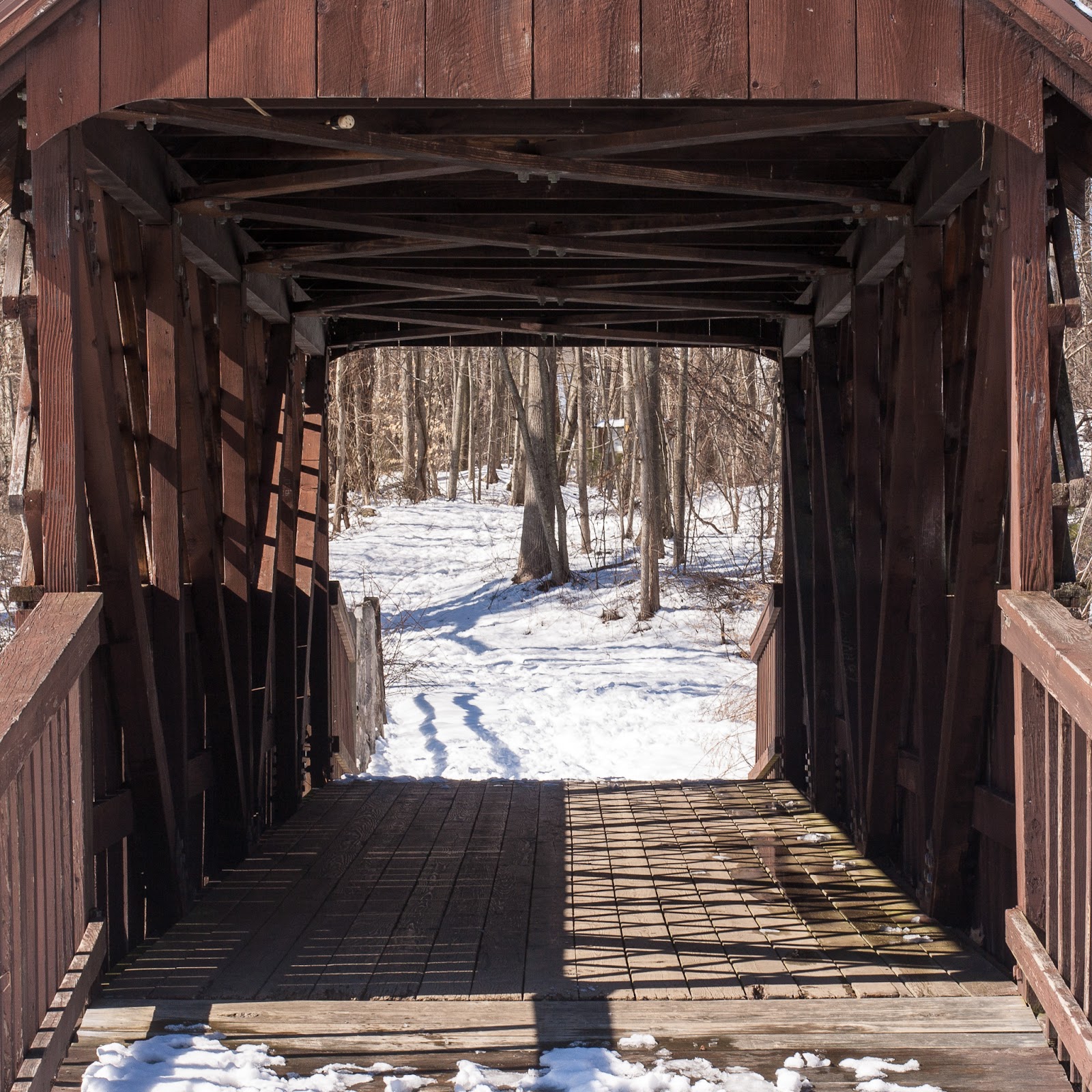
The Huckleberry Hill Bridge in Countryside Park was built in 1968 to cross the man-made pond and waterfall. At least one site claims it is a Town truss bridge, and I can see how they got that impression, because of the non-structural lattice. A look inside the portal clears it up, it's a Pratt truss bridge.


I haven't posted since September; I have some bridges on deck that I wasn't terribly happy with, but will post. This year, though -- I'm gonna abuse the heck out of that covered bridge map.

Saturday, July 7, 2012

Hop River Trail Bridge, Andover, CT

Hop River Trail Bridge
You'll have to forgive me for the number of relatively local bridges I'll be posting about for awhile; it's summer, and I've been building up strength from daily bicycle commuting so that I can get to some of the bridges along the Connecticut greenways. Such as today's bridge, the Hop River Trail Bridge in Andover.


The Hop River Trail is a "rails to trails" project that runs along the right of way of the old Providence, Hartford and Fishkill Railroad. These rails-to-trails paths are fantastic for a walk, jog, or bike ride. The Hop River Trail begins in Manchester and runs all the way to Willimantic. The first time I tried to follow the trail all the way, I got stopped right here in this spot, in Andover, because this bridge was not there and all I could do was carry my bike down the hill and look for the trail to begin on the other side. I never did reconnect with it. Even today, there is no clear path up the other side. The people from the east end of the trail must have been equally stymied by what I understand was called the "Andover Gap".


Portal to the bridge (and my bike!)
This Howe truss bridge was built, years ago, in a factory by Echo Bridge in Elmira, NY. There it sat while Andover moved its slow way toward getting the old railroad bridge abutments reinforced and the bridge upgraded to meet changing safety standards. It was finally trucked here and lifted into place back in April of this year. I added it to my mental list of bike-accessible bridges and forgot entirely about it. Which is what happens to mental lists.


Reminded by Dale Travis' covered bridge lists, I plotted out the 31 mile round trip and had a wonderful time this morning. This really is a great trail, and a covered bridge along the way is just dessert. (I didn't go all the way to Willimantic today because it's supposed to get into the 90s... and a 50 mile round trip was pushing it, I felt.)


Detail of the Howe truss
Trail parking is available at several points near the bridge; if you're arriving by car, there is parking just past the east end of the bridge. The trail head is in Manchester, but there is a huge parking lot where the Vernon/Rockville spur meets up with the Hop River Trail. I've never actually been to the far end of the trail and have no idea what the conditions are like there.

Thursday, July 5, 2012

Meadow Road Bridge/Pequabuck Bridge, Farmington, CT

Meadow Road Bridge
A few weeks ago, I did a mondo post on every bridge on the national historic register in Hartford County. I got most of them. Except the Pequabuck Bridge in Farmington. I thought the Pequabuck Bridge was the one that the Pequabuck River ran beneath. That was wrong.

Still not the Pequabuck Bridge. Is it?
Or, well, maybe not. Because even the Pequabuck Bridge isn't called that any more; it's the Meadow Road Bridge, because the river was diverted at some point to the new place, and now the only really significant thing about the bridge is the path over, part of the East Coast Greenway, a network of paths and trails stretching down the entire east coast.

From the 1984 application for the national historic register
The Pequabuck Bridge is an arched, brownstone span that was built between 1832 and 1833. It's a rubble stone bridge; the outside of the arch is made of shaped and fitted sandstone, but most of the rest of the stones are roughly shaped or not shaped at all. The bridge was built with a wooden structure forming the arch, the outsides of the arch were fitted on that, including the keystones to hold them in place, and then they filled up the frame with stones and lime-based mortar until they filled it to the top. They removed the wooden frame in the arch, and had themselves a bridge.


The wooden bridges I photograph are usually fairly new because wood bridges just don't last -- even if done in the style of the bridge they replaced, they are not the same bridge. This is the real thing. Stonemasons built this bridge a hundred and thirty years ago, and it still stands today. The only change -- the mortar is now concrete instead of lime. This bridge could easily last another hundred and eighty years, especially now that no river runs through it.


Back in the 19th century, this bridge took people from the crowded town of Farmington into what was called the Great Plain, a large plateau of fields, meadows and swamps. This bridge was, then, a vital part of the local economy and needed to be strong and last. This bridge replaced at least one wooden bridge, and you can easily imagine the frustration the townsfolk felt at having to keep repairing and replacing the wooden bridge, causing them to build a bridge that would last.


Part of the Great Plain area was incorporated as the town of Plainville, so that's how that got its name.

I'm just going to copy text wholesale from the historical register application, because the history of the area and its bridges is fascinating.


In  the  second  half of  the  18th  century  the  quest  for  land  to  cultivate impelled the  sons of Farmington residents  to range  farther and  farther  from the  central  settlement.  Led  by members  of  the  well-to-do Cowles  family, Farmington  people  established  farms  in  the  Great  Plain,  the  area  that  was incorporated  as  the  town of  Plainville  in  1869.  After  the  Revolutionary War,  agricultural-based  commerce  underwent  tremendous  expansion,  as Farmington  farmers  sold  their  surplus  output  to  local  merchants  who assembled  shipments  of  grain and  cattle  to  sell  in  the  nation's  growing cities  or  to  export  to  the  West  Indies.  These  two  trends  of  geographic expansion  and  commercial  growth put  pressure  on  the  transportation  routes over  which  farmers  carried their  goods  to  the  merchants  in  the  center. 
Farmers west of  town,  from the  Great  Plain and  its  northern meadows,  had to cross  the  Pequabuck River,  which  lay  between  their  farms  and  the  town  cen­ter,  so  this  crossing came  in  for  close  attention.  In  1801,  the  town meeting appropriated $200  to  improve  the  wooden bridge  then  in  place.  Then in  1819  the  town  rebuilt  it  entirely,  using timber.
Farmington merchants played an  important  role  in  the  promotion and  financing of  the  Farmington Canal.  The  canal  increased  the  town's prosperity,  making it  a  market  center  for  the  region  including not  only western Farmington  but also  Burlington and Canton.  The  surge  in  road  traffic  that  resulted again brought  the  conditon of bridges to  the  top of  the  town's agenda.  In  1830 a committee  of  the  selectmen plus  two western  farmers,  Richard  Cowles  and Joshua  Youngs,  was  appointed to  study  the  town's  bridges.  Two were  found inadequate:  Pequabuck Bridge  (i.e.,  Meadow Road  Bridge)  and  Perry's Bridge in  the  northern part of  town.  The  relatively greater  importance  of  the Pequabuck crossing  is  apparent  in  the  committee's  recommendation to  rebuild it  in  stone,  while wood was  specified  for  the  new Perry's  Bridge. 
The  recommendations  took  full  account  of  physical coordination  with  the canal,  which Meadow Road crossed about  450  feet  east of  the  Pequabuck River. The  committee made  the  requirements  that  the  new  stone  bridge be  the  same height  as  the  one  over  the  canal,  and  that  an  embankment be  built  between the  two bridges  so  that  travel  would proceed at  a  constant grade.  Without the  embankment,  wagons would have  had  to  climb and descend  two  rises within several  hundred  feet.  The  resolution that  approved the  plan was  contingent on  the  canal  company's  agreeing  to  "raise  and extend  the  Canal  bridge embankment between  the  canal  bridge  and  river  bridge,  in  such manner as  that the  one  may be  adapted  to  the  other;  arid  provided that  the  canal  company will  permit  the  town  to  take  gravel  from the  Company's  ground  for  the purpose of extending the  embankment westwardly  from the  river  bridge." 
The  relative prosperity of  Farmington,  and  the  provision of materials by  the canal  company,  enabled construction of  the  stone  bridge.  Connecticut  towns rarely  undertook  such  ambitious bridge-building  projects  in  the  early  19th century;  the  great  majority  of  town  bridges  in  the  state  were  of  wood.  
There  was  not  even a  mason  in  Farmington who  could perform  the  work,  so Horace  Cowles  took on  the  task of  finding  a  qualified contractor.  His  four finalists  came  from the  towns  of  Windham,  Woodbridge,  Watertown and Haddam. (The  contract  for  the  bridge's  construction has  not  survived,  so  it  is  not possible  to  determine  which  of  the  four  actually  performed  the  work.) Farmington was  not  extravagant with  its  public  expenditures,  despite  opting for  the  more  expensive  stone  construction.  Economical  construction  was assured  by  limiting  the  cutting  and  fitting  of  stones  to  only  the  areas where  it  was  absolutely necessary,  the  outside  edges  of  the  arch.  Even with the  savings  from this  technique,  the  bridge  cost  $1,081,  nearly  twice  as much  as  the  $546  it  took  to  rebuild Perry's  Bridge  in  timber.  The  limited use  of  cut  stone  makes  Meadow  Road  Bridge  highly  distinctive.  In comparison,  Hartford's  Main  Street  Bridge,  another  arched brownstone  span from the  early  1830s,  has  cut-and-fitted masonry  for  the  entire  underside  of the  arch,  the  spandrels  and  the  parapets.
The  idiosyncratic  mix of  finished and unfinished stone  identifies  Meadow Road  Bridge as  the product of a  specific  time  and  place.  Farmington  had more wealth than most  inland Connecticut  communities,  permitting the  use  of the  more  expensive  stone  construction.  But  its  people  still  retained  the basic conservative  impulse  of outlying Connecticut  towns,  and  they would not countenance  the  fullest  application of  expensive masons'  labor.  Thus  Meadow Road  Bridge  illuminates  the  concerns of  a  community as  its  economy  evolved from one  of  subsistence and  local  commerce  to  one of market  growth based  on regional  and extra-regional  trade.  The  bridge  also makes clear  the  impact of  the  Farmington Canal.  Not  only did  the  canal  contribute  significantly  to the  growth of  the market economy,  but  it  altered the  physical makeup of  the town  and  forced  the  townspeople  to  adapt  their  road  system  to  the  new conditions.
Meadow  Road  Bridge  belongs  to  an  extremely  small  group  of  early  19th-century,  masonry  town bridges.  Ante-bellum stone  bridges were  built  by the  Housatonic  Railroad and by  factory owners,  but publicly  funded  stone bridges  were  not  common.  Meadow Road Bridge  and  Hartford's  Main  Street Bridge  are  the  only examples of  their  size  known  to  survive  in  the  state.


Wednesday, July 4, 2012

Podunk Grist Mill Bridge, South Windsor, CT

The Podunk Grist Mill Bridge
I just discovered Dale Travis' master list of Connecticut covered bridges and thought to myself, these can't be real covered bridges. There's only three -- the West Cornwall one, the Bulls Bridge, and the Comstock Covered Bridge. How can there be dozens?

Well, by including ones that have never carried traffic. But that's okay, because even a decorative covered bridge is at least decorative :)

I checked through the list for some bridges close to my apartment. It's a holiday and I'm not going to get my daily miles in commuting to work so I'd need to go somewhere else (trying to hit 4000 miles on the odometer by Friday, you see). A new bridge is just the thing.

The Mill on the River Bridge takes patrons of the Mill on the River Restaurant from the parking lot to the eatery. It crosses the Podunk River at a dam.

According to the South Windsor History brochure, this covered bridge was historically a foot bridge (probably uncovered) between the grist mill and a saw mill that stood where the parking lot stands now:

In the northern part of town, another crop was raised in large quantities. This was rye; and another street came to be named after it. Rye Street ran through the high land east of the Scantic River. The production of rye led to the building of many distilleries. The Podunk Grist Mill was first built in 1750 and later rebuilt in 1775 after a flood carried off the first mill. The original dam built for the mill was constructed by colonists and Indians, It was first run by Samuel Rockwell. There was a saw mill on the other side of the river and a footbridge connecting the two. Corn, buckwheat and rye were ground at the mill.

It's appropriate on this Independence Day that I'm writing about a bridge originally built just one year before the first Independence Day!

Sunday, June 24, 2012

Gold Star Memorial Bridge, New London-Groton, CT

The Gold Star Memorial Bridge crossing the Thames
Connecticut sure loves cribbing names from the mother country. London -- sorry, New London -- on the Thames? Though maybe they hadn't actually been to the original London at all, since our version of the Thames is pronounced the way it's spelled -- rhymes with games -- and not the English way, tems.

Once one of the major whaling ports in America, New London continues its maritime traditions to this day. It is the home to the US Coast Guard Academy and Global Dynamics' Electric Boat shipyard, where the US nuclear submarine fleet is built and maintained. Busy ferries carry passengers across Long Island Sound to Long Island, Fisher's Island and Block Island.

The Gold Star Memorial Bridge is a pair of steel deck truss bridges that carry I-95 over the Thames. The first bridge was constructed in 1943, and the second thirty years later. Together, they comprise the largest structure in the state of Connecticut, and by far, the longest bridge.


The bridge is just massive. See how it looms behind those warehouses. It absolutely dominates the river.

Amtrack's Thames River Bridge
Paralleling the Goldstar is the nearly as impressive Thames River Bridge, which carries Amtrak over the river. It consists of four truss spans (Wikipedia calls them Warren truss, but they look like Parker truss to me -- Warren truss bridges have no vertical members) and a lifting section in the middle -- the two towers are a dead giveaway.

Pratt truss railroad bridge
Just before the Thames River Bridge, on the New London Side, is this small truss bridge that crosses a N/S set of tracks. Completely overshadowed by the Goldstar and the Thames River Bridge. Sitting there lonely and rusting.

New London is definitely worth a visit on its own merits; there's lots of remnants of its historic past, its roles in the Revolutionary War and its aftermath. It is one of the earlier settlements in New England. Forts guard the mouth of the Thames. There's even an old sailing ship moored in the harbor.

There's no special place to park for the bridge. It's huge. You'll see it. However, if you're looking for a distinctive place to visit whilst admiring the bridge, why not stop by the Old Town Mill?

Old Town Mill
This mill, built in 1650 by the town of New London's founder, John Winthrop Jr, stands today after having been rebuilt several times in its 350+ year history, including most notably after being torched by the traitorous Benedict Arnold during the British invasion of New London in 1781.


It is literally in the shadow of the bridge.


Saturday, June 23, 2012

Train Bridge, Depot Street, Manchester, CT

Train crossing Adams St
Sure, it's not much of a bridge, but it took awhile to get the picture. This bridge is fairly near my house, and the tracks parallels my ride home. Sometimes I meet the train along the way, but always I'm behind it. If I could only get ahead of the train...

I heard the distant sounding of the train horn this morning... I'd only have a few minutes. I grabbed my iPhone and my bike and got to the bridge just before the train.

So; not much of a bridge, but it's a picture I really wanted, anyway.

Monday, May 21, 2012

Igor I. Sikorsky Memorial Bridge, Stratford-Milford, CT

Igor I. Sikorsky Memorial Bridge
I thought I'd be running out of bridge pictures too fast, so I slowed to posting just once a week. That's kinda backfired, and now I have many bridges on the pile to discuss. Part of my reluctance with some of them is that they are... just bridges. You have the exciting ones, and then you have the more or less standard ones, like this one, the Igor I. Sikorsky Memorial Bridge, which takes the Wilbur Cross Parkway over the Housatonic River between Stratford and Milford.

Route 15 here continues west toward New York and becomes the famous Merritt Parkway, of which I've written. On the Stratford side of the bridge is the Sikorsky Aircraft Company. They make helicopters.


You may have heard of them. The helicopter they have mounted in front of the factory is the first thing I noticed about the place :)

The bridge itself is a standard beam bridge. There is a nice pedestrian/bicycle walkway on the north side of the bridge leading up from a loop park which also extends beneath the bridge. It's a very pleasant stroll, and even though it was pretty chilly the day I went, there were a lot of people enjoying it.

Estuary
You can tell from the barrenness that this was taken a couple months ago. They call this field an estuary, but it looks mowed, which kinda doesn't have the same connotations of unspoiled wetlands that the word conjures up for me. Elkhorn Slough back in Moss Landing -- now there was an estuary.

If anyone asks, I would totally move back to the Monterey area if I could swing it. And I'd take my daughter and her family back with me, cuz I'm totally selfish like that.

Anyway, the Sikorsky Bridge is one of the last bridges on the Housatonic I had yet to photograph. There's the possibility that I will do another state-spanning photography day with the Housatonic, because I'm pretty sure all the bridges along it are easily accessible. Unlike the Connecticut River as it flows through Massachusetts; that river twists and turns and little thought is given to tourists. I tried to get the French King Bridge on my way up to Cow Hampshire last weekend, and had to give up. The only way I could see to get a picture without trespassing in someone's yard on a hill a half mile away (and I was tempted) was to get on a boat.

Anyway I'll probably write that bridge up just to get it off my camera.

Sunday, May 6, 2012

"Q" Bridge, New Haven, CT

Pearl Harbor Memorial Bridge AKA "Q" Bridge
About the picture: There are three bridges in that picture. The one in the background is the Tomlinson Lift Bridge. The one in the foreground is the OLD Quinnipiac Bridge (AKA Q Bridge). The one in the middle -- the one with all the cables -- is the NEW Q Bridge.

I hadn't photographed the new construction since last December, when it was just the concrete posts and some highway stretching away from it in both directions, with only some of the cables attached, and no clear idea how the bridge would shape up.

Construction ca Christmas, 2011
A couple of weeks ago, I read an article in the Courant about the plans for the Q Bridge, along with a rendering of how it would look when completed (read that article here). And then I overheard some people talking about the bridge construction at work!

I really had no choice; I had to return to New Haven and check it out for myself.

The section of I-95 that passes over the Quinnipiac River is one of the most congested sections of road in the state. Everyone traveling from northern or eastern New England to New York City goes through this bottleneck. Traffic is sometimes stalled for miles. The new Q bridge will greatly expand the road's capacity in both directions, as well as using an innovative bridge design not before seen in the US, the "extra-dosed" cable design.

Gulls
These seagulls were hanging around on Long Wharf, so I took their pictures. It's not ALWAYS about the bridges!

Closer look at the cable supports
Parking is easy, just follow the signs for Long Wharf and park in any of the small parking lots. If you go up Chapel Street, there's some parking at a sports field just north of the bridge. If the traffic is bad that day, you can park on I-95 itself in a traffic jam for an up-close look at the new construction.

Wind Turbine
If you choose to park at the sports field, you get this awesome wind turbine for free.

Here it is again!
That turbine looks even more awesome from the OTHER side, looming behind the bridges...

Sunday, April 29, 2012

Merritt Parkway, Greenwich, CT

North Street Bridge
Kind of an unusual shot. I was on my way back from Virginia. I usually swing wide to avoid major cities -- and their tolls -- but this time, I made the straight shot up the coast on Route 95 and the NJ Turnpike. So many tolls. So many great bridges, too, from the Woodrow Wilson in DC to quite a few in the Baltimore area to the absolutely stupendous Delaware Bridge and just as twilight ended, over the George Washington Bridge. I didn't get pictures of any of them. Someday.

I was out of money after the Geo. Washington, so I figured I'd avoid the toll in White Plains and just go up the Hutchinson Parkway to my old friend, the Merritt Parkway, home to some of the most intriguing bridges in the state of Connecticut. It being dark, I didn't expect to get any pictures... but Fate intervened.

There was a tragic accident up ahead, and we ended up parked on the parkway (aha!) for a good forty five minutes. Right in front of the North Street bridge in Greenwich. Rested the camera on the dash and got this long exposure picture.

Merritt Parkway
I had bought a dashboard mount for my iPhone awhile back with the intent of taking pictures from the car of the Merritt Parkway bridges because I couldn't think of any better way to take pictures of dozens of ornate bridges from a highway where places to stop were rare and in any case, not well-placed for bridge photography.

The pictures came out -- sorta. This one above, from outside the Sikorsky plant in Stratford, I took with the regular camera. When the Merritt Parkway was first built, each underpass and overpass was designed to reflect a different art style or construction technique. The planners just wanted to make a really beautiful road for travelers from or to New York to skip past the coastal cities on Connecticut's "handle". The bridge above would have worked just as well without the iron leaves... but it was more beautiful with them.

I'm adding some of the pictures automatically taken on the car trip below. Not great quality, I just had the iPhone on the dash snapping whatever it saw every three seconds, but it should give an impression of the wide variety and detail of the bridges on the Merritt Parkway.


Saturday, April 14, 2012

Talcottville Iron Bridge, Talcottville, CT

Talcottville Iron Bridge
This one's a local bridge -- it's right down the road, yet I'd never heard of it until today, when I ran across it while photographing the Talcottville Mill. It crosses the Tankerhoosen River just above a dam on Talcottville's Main Street. It's a pony truss bridge made, presumably, of iron.

The historic bridge site says this bridge was built by the famous Berlin Iron Bridge Company, and is the only pony truss bridge where the truss members actually bear the weight of cars crossing the bridge. A pony truss bridge, by the way, is one with no trusses connecting the sides along the top.

I was in my car, since I was coming back from a photography trip up in Shenipsit State Park, but this is a bridge that needs my bicycle on it.

Talcottville Mill
This mill was the center of Talcottville for decades. The Talcott brothers had bought the mill and the surrounding lands from Nathaniel Kellogg, who had named the area Kelloggville. No shortage of ego on either side, there. The Talcott brothers built twin homes across the street on hills, overlooking the mill. The mill remained active in some form through the 20th century, though it is all entirely abandoned now.

Just about time to recondition it into luxury apartments...

You can (and should!) read more about Talcottville's historic legacy, as the story it tells is repeated, with minor variations, throughout the northeast. Talcottville today is a historic district within Vernon, CT, and signs along the few roads point out and explain the historic significance of the mill and other relics of an elder age.

Saturday, March 31, 2012

South Maple Street Bridge, Enfield, CT

South Maple Street Bridge
This isn't the first time I missed a historical bridge and had to make do with the replacement, but in this case, I'm pretty happy about it. The previous South Maple Street Bridge was a low, pony truss bridge, one of many at this site. Its replacement, above, is something entirely new.

New for Connecticut, anyway.

This bridge was built in a factory in several locking pieces before it was brought to this site and assembled in place. The masonry at both ends of the bridge is a facade, molded into the concrete when it was poured on a factory floor. It's steel reinforced concrete through and through. This is the first bridge in the state to be entirely prefabricated offsite.

Old South Maple Street Bridge
I was in the area for the Scantic Spring Splash, an annual river race for kayaks and canoes down the Scantic River from Somers to Enfield. When I read the finish line was a bridge, it had to be my bridge of the week.


There was a shuttle bus between the Enrico Fermi High School and the Powder Mill Barn; those wishing to see the bridge when there isn't a race going on can likely park at Powder Mill Barn. There is also some parking at Powder Hollow Park, immediately adjacent and on the other side of the river. Plenty of family friendly hiking trails, and be sure to bring your dog. Everyone else does!

Sunday, March 25, 2012

Charter Oak Bridge, Hartford-East Hartford, CT

Charter Oak Bridge
It doesn't carry as much traffic as the Bulkeley Bridge, and it isn't the city centerpiece that Founders Bridge is, but the Charter Oak Bridge, the third (and newest) of Hartford's bridges across the Connecticut, has its own reasons to shine.

The Charter Oak that gave its name to the Hartford neighborhood where this bridge lands is a tree of legend in Connecticut. In 1662, the story goes, King James II decided that the colonies had had quite enough of this independence thing and appointed a governor, Edmund Andros, over the newly created Dominion of New England. When he arrived in Hartford to revoke Connecticut's charter, he was shown it, and then the candles blew out. When relit, the charter was gone -- hidden, it was said, in a huge oak tree, the Charter Oak, in south Hartford. In 1689, Andros was deposed and the Dominion of New England dissolved.

The original Charter Oak was split by lightning 150 years later, but its descendants live on, and the wood of the original tree was made into a chair which stands now in the State House.

Connecticut has always prided itself on its independence -- it was the first state to ratify the Constitution. The Charter Oak is Connecticut's symbol.

Charter Oak Bridge from the tour ship landing
The East Hartford side of the bridge stands in a small park which is (unfortunately) rather marshy. The Hartford side ends in Charter Oak Landing, the main dock for boats both personal and commercial in Hartford.  The Lady Katherine river tours leave from here. (The boat used to leave from Riverside Park near Founders Bridge, dunno why they moved down here). The public landing is on the south end of the park; the north end gives magnificent views of of the Colt Park section of Hartford (marked by the colorful dome on the old Colt Firearms factory) and of the Hartford skyline.

Charter Oak Landing
This picture may have been processed a little bit. I was having some fun with the new version of Picasa. You can see the Colt factory dome on the left of the photo.

Obligatory car shot
I don't honestly know how to get to the park in East Hartford. I've only been there on my bike, and I got there from the bridge itself, which features a wide, separated bike path on the north side. Charter Oak Bridge carries routes 5 and 15 over the river; following those signs will get you there. Or just click on the location information beneath this post and use Google Maps to get you there.

I've gotten to the end of this post without talking much about the bridge itself. You can see from the pictures that it's not all that special, a very modern girder bridge built with steel and concrete, similar to the East Windsor river crossing. It was built between 1988 and 1991 to replace an earlier bridge at the same point. Anyone going from I-84W to I-91S will cross the bridge and will never see the beautiful parks beneath it.