My best friend texted me this morning, asking what bridge I was going to hunt today. I wasn't planning on hunting any bridges today, because the day was gray, I have so many bridges in my backlog, blahblahblahblahblah. Well, there's this swing bridge down in New Haven I hadn't ever gotten, and it's just 45 minutes away, so I figured I'd just pop down and grab it. Better than wasting the day away doing laundry.
Note to self: still need to do laundry.
The Grand Avenue Bridge connects the Fair Haven and Fair Haven Heights neighborhoods across the Quinnipiac River. It swings upon signal during the day except for the morning and evening rush, and at night by calling at least an hour ahead and getting someone to come out to the bridge house there in the center and open the bridge manually. No boats were in the vicinity of the bridge while I was there. It would have been fun to figure out how to transmit the signal and make the bridge open.... I wonder if people do that.
Detail of the bridge house
I've read rumors that this bridge is due to close permanently. I'm thinking that's a little bit of hyperbole. There are some articles in the local paper on closing the bridge temporarily for repairs, but a bridge with this many moving parts is going to need maintenance. This bridge isn't going anywhere. Except 90 degrees clockwise, sometimes.
The Fair Haven neighborhood was once known as "Dragon", and the original bridge that crossed the Quinnipiac at this point, was the "Dragon Bridge". That bridge was replaced in the late 19th century with this more modern one by the famous Berlin Iron Bridge Company that built iron bridges throughout the northeast. This is an astonishingly intact example of a bridge from that era, and I'm certain it's had extensive reconstruction. A little bit of living history. One source says the old bridge was replaced by a newer bridge of the same design back in the 1980s. This account is confirmed by the documents on file with the National Register of Historic Places, which says:
On the east bank of the river there are fewer open spaces due to demolition. The major losses have been confined to the commercial buildings on the south side of East Grand Avenue near the bridge. The bridge itself was dismantled, but is now in the process of being rebuilt on the original location and according to the same design as the turn-of-the-century bridge.
Pre-reconstruction Grand Avenue Bridge
The New Haven Colony Historical Society Photo by William K. Sacco
As you can see from the picture above, the new bridge is an exact recreation of the old one. The city of New Haven wanted to make it wider and more modern, but popular outcry forced them to keep it the way it was. Whether people were complaining because they liked the old bridge, or because a newer bridge would have meant the destruction of more property, I don't know. But I'll take any Berlin Iron Bridge I can get. These bridges don't only signify New England to the world, they mark Connecticut in particular. Like the Town lattice bridges before it, Berlin Iron Bridges are living examples of Connecticut's historic leadership in civil engineering.
About a year and a half back, I capped off a post about a trip to the Braga Bridge in Fall River with a tease about a sighting of a suspension bridge far in the distance -- the Mount Hope Bridge. And that was the last I posted for months.
I wasn't thrilled by any of the pictures I took that day, really, and considered it kind of a wasted trip. A viaduct hunt had not gone well. The Braga Bridge was lit all wrong. Another bridge I wanted to photograph, I could only see when I was driving over it. And they NEVER let you get out of your car on those things. Got home, saw these pictures, and they just didn't do the bridge any justice at all. Because this is a gorgeous bridge.
It's also the only bridge that will get you onto Aquidneck Island (and down to Newport) without a toll. You might wonder if it's worth the inconvenience of coming into the area from the north to use this bridge just to avoid a few bucks in tolls, but my father would go ten miles out of his way to avoid a four bit toll, so... keep that in mind.
Driving over the Mount Hope Bridge
I wasn't holding my phone to take these pictures as I drove. I have a dash mount for the phone. Regret not bringing it for the Bourne Bridge last weekend, but anyway.
The Mount Hope Bridge was completed in 1929, just days before the stock market crash and the Great Depression. It's over a mile long and 135 feet high in the middle. There's several parks in the area, and if you're into sailing -- you're just not going to find a prettier group of bridges to sail under than the three that cross the Narragansett Bay.
This was a warm, September day -- after the America's Cup races, I think. I missed those because of the crowds. I did get a really good look at the underside of the bridge from one of these parks, one that seemed claimed by locals.
Underside of Mount Hope Bridge
I've seen this kind of cladding beneath bridges many times -- in the Sagamore Bridge post, you can see sheeting covering the bottom of the bridge in both directions. I'm not sure why they put it there. In this case, it might be to protect the people working on the bridge. Dunno.
The Mount Hope bridge was the longest suspension bridge in New England until the nearby Clairborne-Pell Bridge took the crown some years later.
The longest covered bridge in New England (and, until 2008, in the entire country) is going to be the topic of the next post, maybe. In a year and a half :)
It's been a year since my last post... this is a gap too long. I've still been taking bridge pics, just -- not posting, for some reason. I dunno. New bridges mean driving further and further... still worth doing, but now they require a bit of planning to get to.
Spring has finally come to New England after a horribly long winter. I've been wanting to hunt the bridges that cross the Cape Cod Canal for a long time, but it's always been either too cold, or too filled with tourists. These bridges are a huge bottleneck for people traveling to and from the cape. The roads from Bourne to Provincetown are narrow and slow. There might be just a couple of weekends left before the antique shops re-open and the cars start to pile up. This was my chance to get these bridges before it was too late for another year.
Buzzards Bay Railroad Bridge, and OMG MY CAR!!!
The Cape Cod Canal is a seven mile canal formed by connecting and widening two rivers that allow shipping to and from further down the East coast to get to Boston-area ports without having to round the cape. The Wikipedia mentions that George Washington once surveyed a potential path for the canal... building on work the Pilgrims had begun a hundred years earlier. This canal, though, is only about a hundred years old.
The Sagamore Bridge on the north end of the canal, and the Bourne Bridge near the southern end, are both steel arch bridges with suspended roadways. They carry a substantial number of cars each day, but during summer, the lines of cars waiting to cross can reach miles long. This is why many residents opt to use the Cape Cod Canal Tunnel to skip the crowds.
Bourne Bridge
It was pretty cloudy when I got to the cape, so I apologize for the dullness of the Bourne and railroad bridge pictures. When I got to the Sagamore Bridge on the way home from Provincetown, the day was much nicer. I probably should have gone back to Buzzards Bay and re-taken those bridge shots, but -- it had been a long day.
Long, paved trails stretch along both sides of the Cape Cod Canal, and both sides were crowded with people out for a walk, a bike ride, or roller blading. I really should have brought my bike. Behind the Bourne Bridge in the picture just above are a few wind turbines. The constant winds through the hills surrounding the canal turn the turbines and help power the Massachusetts Military Reservation. Cape Cod will also soon host the Cape Wind project, an offshore wind farm that has just last week cleared its last legal hurdle. Detractors claim the sight of turbines turning lazily on the horizon will kill the tourist trade (and unwary seabirds), but.... I have loved wind farms since I first saw the ones in Pacheco Pass and Altamont Pass back in California.
Here's a better picture of the Buzzards Bay Railroad Bridge, AKA the Cape Cod Canal Railroad Bridge, without my car in it.
Cape Cod Canal Railroad Bridge
This bridge, the southernmost bridge over the Cape Cod Canal, is a lift bridge that services the tourist trade -- a local area tourist train (the Cape Cod Central Railroad) and an express train from the Boston area (the CapeFLYER). Since I went out of season, neither train was running and the bridge stayed up the entire time I was in the area. There's enough traffic in the canal to keep boat watchers happy; while I was photographing the Sagamore Bridge, a tug pushing a barge, followed by another tug, zoomed by.
I'm disappointed in myself for taking so long to visit these wonderful bridges. Best thing about them is -- there's an entire cape of wonderful things just pass them.
Cape Cod Highlands Lighthouse, Truro
Edward Penniman House, Eastham
Pilgrim Monument, Provincetown
Town Cove, Eastham
It's not easy to miss these bridges if you're going to Cape Cod; in fact, they're impossible to avoid. All pictures were taken with a Canon G 1X point and shoot camera. I brought my Canon DSL, but I just ended up using the small camera because the pictures were coming out just as nicely.
It's the last snow of the season, and the time is running out to get some covered bridge pictures before the last snow. The snows we have gotten this winter have either been so light to not make the trip worthwhile, or so heavy that I couldn't drive there safely.
Come the perfect storm -- so to speak -- Friday. The heavy, wet snow had made us work from home, but the weather Saturday -- today -- would be so warm that traveling wouldn't be an issue. I only needed to find a bridge to get to before the snow melted, given I had to work in the morning.
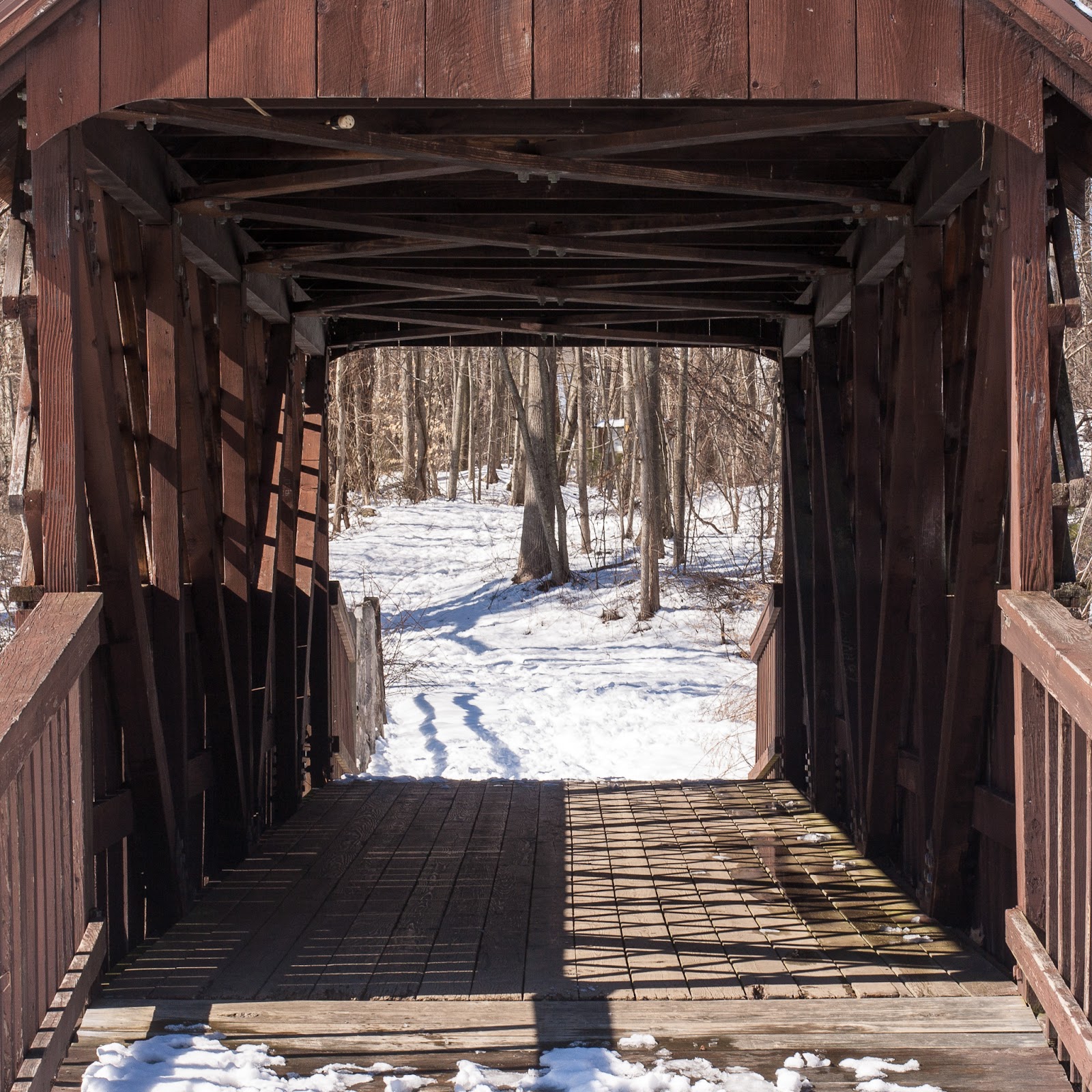
The Huckleberry Hill Bridge in Countryside Park was built in 1968 to cross the man-made pond and waterfall. At least one site claims it is a Town truss bridge, and I can see how they got that impression, because of the non-structural lattice. A look inside the portal clears it up, it's a Pratt truss bridge.
I haven't posted since September; I have some bridges on deck that I wasn't terribly happy with, but will post. This year, though -- I'm gonna abuse the heck out of that covered bridge map.
My group at work changed floors; now we're located with the business folks (for whom we're the IT department), and I get to listen to the business folk talk about the business. And one mentioned the Braga Bridge.
My ears perked up, as they always do when bridges are the topic. But especially the Braga Bridge -- I knew that bridge. I had a picture of that bridge.
I got this picture on my way between two other bridges, neither of which I have written about. Because the pictures weren't great, the light was wrong... as they are with this bridge, the Braga Bridge, about which a haiku contest was run:
Six-lane thoroughfare;
Minus two lanes of repair;
Four lanes of despair.
— Jay Martineau, Westport
I grew up not terribly far from here, and some school trip or other got us visiting the Battleship Massachusetts, which is permanently docked on the Fall River side of the bridge (you can see it there, though the battleship gray blends in so perfectly with the water and the background that it's almost like it was designed to...)
Bizarrely, I don't remember this bridge from when I was a kid. I have no explanation.
Replica of the Iwo Jima Memorial
I shot the bridge from a really beautiful park along the Taunton River just up from the bridge and just below a rather ordinary bridge that I couldn't get any sort of picture of. The park is dominated by a replica of the Iwo Jima Memorial. I had no idea it was there. I love most being surprised by the things I find when I'm bridge hunting.
Brayton Point Power Plant
Across the river from the park is the Brayton Point Power Plant, which I assumed to be nuclear, but is actually a coal powered generating station.
The Braga Bridge is much longer than I show in the picture, but it's hard to get the entire bridge in a shot, and stitching all the pictures together doesn't look cool. It's all a deck truss bridge up until this Warren truss bit on the Fall River side... so in your imagination, draw an endless line to the right. The whole bridge is over a mile long.
I was going to head down to the USS Massachusetts and try to get a more oblique shot of the bridge... but then I noticed something in the distance behind the Braga Bridge.
OMG... what bridge is THAT?
THAT... is the Mount Hope Bridge in Bristol, Rhode Island. And it instantly became the next stop on my hunt.
What was the first stop? The reason for the trip in the first place?
It was a viaduct about which Wikipedia had said was almost impossible to photograph without trespassing. I took that challenge. Someday I'll let you see how it turned out.
I stopped in historic Fredericksburg, Virginia, on my way to visit my son this past weekend. Traffic along I-95 made it dark before I got to town, so I made sure to rise with the sun the next morning in search of the fanous Rappahannock River railroad bridge.
It's a concrete, eight (or so) span open spandrel arch bridge. The bridge is in active use by cargo and passenger trains; there is a beautiful Amtrak station just a block west of the bridge. It's a wonderful river crossing in its on right, but this is not the bridge that made Fredericksburg famous.
This bridge is very near the former site of an earlier bridge -- a bridge that was instrumental in one of the most one-sided battles in the Civil War.
Mural of the bridge on a Fredericksburg wall
In December of 1862, Union forces, desperate for a victory, were looking for a victory against Confederate forces entrenched in and around Fredericksburg. Blocked by the Rappahannock River, a tributary of the Potomac River, the two sides stared at each other until the Union Army could deliver sufficient pontoon bridge segments to build a bridge across the river -- which the army proceeded to do, under continual fire from the Confederates.
The pontoon bridges prior to the Battle of Fredericksburg (ca 1862)
The Union army, encamped on the east side of the river very near George Washington's boyhood home, crossed the pontoon bridges, taking heavy losses, and entered into close combat with the Confederates among the streets and homes of Fredericksburg, eventually making a concerted effort to break the fortified lines on Marye's Heights.
They failed and were forced to withdraw. Union losses were twice those of the Confederates, a bitter loss that shook the North's already fragile support for Lincoln's War.
A riverboat idles at Fredericksburg's City Dock as geese fly overhead
Fredericksburg today is an arts center for the area and home to the University of Mary Washington. It has a thriving night life and is extremely bicycle-friendly -- many of the city streets encourage bicyclists to use the entire right lane.
It also sports the second largest mall on the East Coast, the Central Park Mall, which makes travel on the outskirts of the city problematic during shopping hours.
My car tires were about to dissolve into the road unless I got them replaced, so until I could save up enough money for a new set, I haven't been going much of anywhere for the last month or so. But a dear friend was flying from Texas to Rhode Island for a conference, and I wasn't going to get to Providence on a bicycle.
After dinner, I was able to coerce him to come with me bridge hunting. I've taken pictures of the Providence River Bridge before, but... never at night.
Lit up, the bridge sparkles like a jewel on Providence's waterfront. It's so bright that local astronomers insisted it be turned off at 11PM so that the stars could be seen.
The Providence River Bridge, the widest network lattice arch bridge in the world, was built at a warehouse about fifteen miles down Narragansett Bay and transported up-river to its current spot. This move was the subject of the History Channel documentary, "Mega Movers: Really Big Bridges". Since I last wrote of this bridge in July, I've had a chance to watch this documentary. It's pretty incredible.
To move the bridge, they first had to construct four giant winches to lift the bridge onto specially constructed trucks with over a hundred wheels between them, that, incredibly slowly, inched the bridge onto two barges that were connected by steel bracing. These barges were then pushed by tugboats up the bay to Providence. Any misalignment would send the bridge into the bay.
Total professionals they were; the bridge made it without incident.
Sorry about the reflections. I wasn't using a lens hood and this is what happens.
The West Swanzey Covered Bridge, AKA the Thompson Bridge, was built in 1832 by Zadoc Taft for the princely sum of $523.27. Zadoc isn't a name you see every day. He's not even the most famous Zadoc Taft -- that honor goes to renowned sculptor Lorado Zadoc Taft.
Our Zadoc Taft, though, was a local boy, born, raised and died in the area. The Register of Historical Places entry for this bridge lists Taft as a master workman, but by the 1850 census, he called himself a blacksmith. Further information about Z. Taft isn't easily found; there was a Revolutionary War soldier by that name who lived in southern Massachusetts near where I grew up, apparently unrelated, and another around the same time who ran a mill in Bennington, Vermont, where my sister went to college. That could conceivably be the same person, as Richmond and Bennington were probably within a few hours travel by train, but it seems unlikely.
The Thompson Covered Bridge crosses the Ashuelot River, connecting the town of Swanzey with the village of West Swanzey. It's a two span, 155 foot long, single web Town lattice bridge. The sides are open and use the beautiful Town lattice as a decorative element. There is a sidewalk on the south side of the bridge; there apparently was another on the north side when the bridge was built. It's not known to me what happened to it.
By the early 1970s, increasing traffic was taking a toll on the wooden bridge. Although there is now another bridge nearby to carry trucks, buses and other heavy traffic, in the 70s the weight limit was six tons. School buses would drop their kids off on one side of the bridge, drive to the other, and weight for the kids to cross the bridge, board the bus, and continue on its way. Currently, the bridge is signed for only three tons of traffic -- one car at a time on the bridge's single lane.
The Thompson Covered Bridge is #5 in the southern New Hampshire covered bridge registry. Of all the covered bridges I've seen here in New England, this is the most beautiful and best preserved. It looked substantially similar to this in 1832, 180 years ago. Zadoc Taft should be proud.
Usually a bridge like this has a lot of history behind it, but I can't even get a definite idea of its name. Some places call it the Ashton Bridge, some the Ashton Viaduct. I imagine it was associated with the nearby (like, if I turn to my right 90 degrees, it's right there) Ashton Village, which was once a thriving mill, so it must be at least a hundred years old, but... no information on how old it is.
I was biking on the Blackstone Valley Bikeway which stretches from Worcester, Massachusetts through to Cumberland, Rhode Island. I was just wanting to see how far I could get, maybe to where I grew up near Uxbridge, Mass., before we moved to New Hampshire. The Blackstone Valley was home.
Yeah, I knew the viaduct would be along the way, but still. I didn't come just for the bridge. Honestly.
The Ashton Mill
Told ya the mill was close.
Viaduct & bike bridge
The Ashton Viaduct is a five span open spandrel arch bridge crossing the Blackstone River, a river once called the most polluted river in the country with respect to toxic sediments, being used as it was as the industrial toilet for mills and factories from Worcester to Woonsocket. It is today still filled with pollutants. In that it shares a fate with the Housatonic River here in Connecticut -- enjoy at your own risk.
Neither river is likely to ever fully recover.
Not the Albion Bridge
Further along the bikeway, I found a pony truss bridge crossing the river. It looked in great condition, better than I'd ever seen one from the age of iron bridges. It didn't look to be one of the Berlin Iron Bridge Company's bridges -- most of theirs are lenticular.
Boston Bridge Works Builders
These bridges were built by the Boston Bridge Works... at least originally.
Turns out that Rhode Island replaced the bridge, then bolted on parts of the old bridge so it would keep some of its old character. According to the contractor, Gordon R. Archibald Inc Civil Engineering,
To maintain the historic value of this river crossing, Gordon R. Archibald, Inc. developed the innovative concept of 'aesthetic rehabilitation.' Under this concept, the trusses were refurbished and placed astride a new, two-dimensional steel grid superstructure. The steel grid carries all of the new superstructure and vehicular loadings, leaving the trusses to carry only the weight of and loadings on the sidewalks. In this way, the reconstructed bridge can carry contemporary traffic loadings, while its 19th-century visual quality is preserved for future generations.
So I'm not sure how I feel about that. I guess it's good that they didn't just replace it with a slab of steel and concrete. They replaced it with a slab of steel and concrete and then put it in a dress.
The Contoocook Covered Bridge, crossing the Contoocook River in the Contoocook village part of Hopkinton, New Hampshire, bills itself as the "oldest surviving covered railroad bridge in the world". That's a lot of qualifications, but it's still an impressive piece of covered bridge history.
Constructed in 1889 on the piers of an earlier bridge, it was built at a time when New England was turning to iron bridges, such as those built by the famous Berlin Iron Bridge Company. Its relative newness could be responsible for its longevity, maybe.
This bridge was probably designed by the Boston & Maine Railroad engineer Jonathan Parker Snow and built by carpenter David Hazelton. The B&M railroad used wooden bridges long after most other railroads had moved to iron.
Tradition. It's New England!
Double Town lattice
The Contoocook covered railroad bridge sports a rather unique double Town lattice construction, with a second lattice bolted to the outside of the first. This probably helped take the weight of trains as they came through to the nearby depot. I have not seen that in any other covered bridge, but Wikipedia claims it wasn't uncommon in northern New England and a few other examples survive to this day.
This bridge was used as a working railroad bridge to 1962, weathering a number of disasters, including the 1938 hurricane that nearly wiped out Providence, Rhode Island. Between 1962 and 1990 it was used as a warehouse. In 2006, the National Society for the Preservation of Covered Bridges paid for some necessary upgrades, and in 2010 the NH Department of Transportation modernized the lighting and fire suppression system -- you can see the red fire alarm button midway down the bridge wall in the picture above.
Portal to Contoocook Covered Bridge
I used to live twenty miles from this bridge when I was a kid, but I didn't know it even existed until a couple weeks ago. Used to ride to Hopkinton on my bike a lot after they built this really nice bike path that follows Interstate 89 north. But it would have been being used as a warehouse back then, anyway. The pictures on the Library of Congress website (which is down at the moment, so no links) show it filled with junk. Now it stands as the centerpiece and symbol of Contoocook village.
The bridge isn't hard to get to; if you're anywhere in the Concord, NH area, get to I-89, go north to route 127 and follow the road into Contoocook. There is parking available both at the adjoining depot and a restaurant on the other end of the bridge.
I hadn't been to the top of the Empire State Building since I was a kid, and my daughter had never been, so Wednesday we made the trip. Even though the the air was hazy with humidity, it was a great view and I got some wonderful pictures of the lower Manhattan bridges before the thunderstorms hit.
Closest to us was the Ed Koch Queensboro/59th Street Bridge, looking from this height like a kid's popsicle stick bridge.
This morning I went to see the new Batman movie, the Dark Knight Rises, in which many of the bridges of Manhattan play a pivotal role -- and the Queensboro Bridge, most of all. I'm not going to spoil the movie, but if you've been a fan of Manhattan's bridges, you'll probably enjoy the focus on them in the movie.
Except -- one tiny, tiny thing. They moved the bridge. They moved the bridge. In actual real Manhattan, the bridge is midtown, connecting the island with Queens. In the movie's climactic scene, the bridge has apparently replaced the Verrazano Narrows Bridge, Staten Island has disappeared entirely, and the Marine Parkway Bridge now connects to Manhattan. Or something. And is now reddish instead of gray.
When I got home I checked a NYC map just to be sure I wasn't crazy, but I was right. They moved the bridge.
I wasn't going to write this picture up. There's nothing particularly historical about this bridge. I didn't even know this bridge existed.
I'm on vacation, and I'd made a promise to visit my parents graves in Concord, New Hampshire, at some point during my week off. My dad would never, ever pay a toll if he could avoid it, and particularly on I-93 between Manchester and Concord. He'd always take the back road, Route 3A, through Hooksett and Bow and into Concord, where we lived.
That's how we kids were brought up. So I was toodling along on 3A, which follows the Merrimack River, just casually looking over now and again because it's a beautiful river and it was my river growing up. Through the trees, I saw an old iron railroad bridge and figured I'd better stop by.
I didn't recognize the truss design; I looked it up when I got home and saw it was a "Baltimore truss". The railroad bridges here in Connecticut all seem to be Pratt truss, so that was new.
This closed-off railroad bridge crosses the Merrimack nearly parallel to the Baltimore truss bridge. This one appears to be a three span Pratt truss bridge with extra bracing. Or it could be a Warren truss. I don't know. The cool thing is that these bridges, right next to each other, were made using entirely different designs.
Lots of people seem to have photographed these bridges (add me to that list) and/or jumped from them, but I'm not able to find any information about them online.
Franklin D. Roosevelt Mid-Hudson Bridge from Walkway Over the Hudson
I'm listening to Joseph Bertolozzi explain to me the various sounds the Mid-Hudson Bridge makes when you hit various parts of it with various kinds of hammers and mallets. This is the "album only" track from his 2009 album "Bridge Music", percussion music composed and played solely with sounds produced by the Mid-Hudson Bridge.
Bridge Music
You can hear this music on the bridge itself at the various listening stations, or on the radio.
Mid-Hudson Bridge and Walkway Over the Hudson
Because there were no fixed bridges across the Hudson south of Albany at the time, the Mid-Hudson Bridge
between Poughkeepsie and Highland was proposed in 1923 and opened in 1930 to fill a desperate need for road access. Then-governor Franklin D. Roosevelt, who grew up in nearby Hyde Park, was on hand for the opening of the bridge which would, in 1994, be renamed after him.
Detail of the underside of the bridge
The bridge is 3,000 feet long and rises 135 feet above the Hudson. It carries state routes 55 and 44 over the river, and the toll is $1.50 heading east. I didn't have to pay because I took my bike this time.
The pedestrian walkway on the north side is part of a loop trail that connects with the linear park on the old Poughkeepsie Railroad Bridge, now known as the Walkway Over the Hudson, and the topic of another post. Plans are to eventually connect this loop trail -- about three miles -- with the Dutchess County Rail Trail system.
The cable stays on the west end of the bridge
Parking is available at both ends of the Walkway Over the Hudson, with easy access to both the bridges. The pictures from ground level, below the bridges, were at the end of Mile Hill Road, which leads to a small isolated riverfront community.
If you're on a bicycle, you really have to respect roads called Long Hill Road, Mile Hill Road and so on, because... they aren't lying. Mile Hill Road would have been a fun descent if I were any sort of fan of screaming down strange curvy roads at 50 mph, but I have to admit I was clenching the brakes the whole way down. And I walked the bike the whole way back up, too. I'm not proud.
There were a couple more bridges I wanted to get this trip, but I'd been in the sun long enough for one day. The Rip Van Winkle Bridge is just going to have to wait.