Tuesday, January 31, 2012

Cornwall Bridge, Cornwall Bridge, CT


That's not a typo. Cornwall Bridge is actually within the town of Cornwall Bridge. It carries Route 7 over the Housatonic, and is just a few miles south of West Cornwall Covered Bridge, the bridge from yesterday's post.

The Cornwall Bridge is a six span, open spandrel concrete arch bridge. It really sounds like I know what I'm talking about when I write that. It's a huge bridge, but crossing it by car, there is no clue as to its size or beauty. You have to stop the car and look over the side -- or drive down the steep hill past the tourist shop and the church and just be bedazzled.

I learned a few important things from this trip. First is, _charge your camera battery_. I don't know why I didn't. I thought of it the night before and that very morning, but just assumed I'd have enough charge. I didn't. The camera was gasping along on fumes here. It'd shut off. I'd wait a few seconds and turn it on and get another shot or two. It would shut off again. I managed to make it through this bridge, but it totally gave up the ghost on the next stop in New Milford at the Lover's Leap Bridge. I had to rely on my phone's camera for most of those shots. And then it ran out of power, too.

So, lesson learned. If you're going to drive a couple of hours to get someplace beautiful, and you have a full slate of bridges to photograph as well as a hike, make sure you are _prepared_. I didn't prepare then.

Maybe lesson not learned. I rode my bike five miles in the wrong direction this morning because I didn't check my map carefully enough. Late for work, too.

If you plan to visit the Cornwall Bridge in Cornwall Bridge, you can park at the foot of the bridge itself, as the creepy pickup truck with its lights on was doing in the second picture. What was up with that. Or, you can park up top at the trailhead to the Mohawk Trail. Which I did.

The Mohawk Trail climbs Breadloaf Mountain and joins at the summit to the Appalachian Trail. It's entirely possible to take the trail from here, all the way south to Bulls Bridge and then leave Connecticut at that point for New York, keep hiking, and come eventually to the Bear Mountain Suspension Bridge over the Hudson. I would love to do that someday -- just hike the Appalachian Trail for a few days.

This far south, the Berkshires aren't really a mountain range; more a series of tall hills, yet the hike is fairly strenuous. It's well marked, but don't expect the paths to be to the well-trod level of the ones up at Shenipsit State Park. The trail is steep and rocky and you will be grabbing at trees to help get up and back down again.

Summit of Breadloaf Mountain
But when you do get to the top -- heaven. The panorama above was taken with my phone; the sunlight reflected off the scrape on my Canon's lens in such a way as to ruin every shot. It's hard to get a good shot of the Housatonic River valley far below. The summit is cleared out with plenty of bare rock on which to build a fire; many, many hikers likely have done just that.

Monday, January 30, 2012

West Cornwall Covered Bridge, West Cornwall-Sharon, CT


The third and last covered bridge in Connecticut, the West Cornwall Covered Bridge, crossing the Housatonic about 20 miles north of Bulls Bridge, a covered bridge in Kent. If you're already headed to the Berkshires to see one of them, you might as well see the other. And as long as you're coming to see _those_, you might as well stop by the Cornwall Bridge, a huge arch bridge in the town named Cornwall Bridge. That's a different post, though.

Of the three covered bridges in Connecticut, this is the largest, though still not wide enough to let two cars pass inside. Wikipedia says the bridge was originally built in 1864. Covered bridges weren't terribly rare back then; if you're going to be building a wooden lattice bridge anyway, not much reason not to wall it in and put a peaked roof on it to protect the deck from the weather. According to the Connecticut Historic Bridge site, the state department of transportation concealed steel beams in the flooring (same as they did with the Comstock covered bridge) to keep it safe for traffic. During last year's tropical storm, the Housatonic became violent and deadly -- but the bridge weathered it without damage.

For all the businesses in West Cornwall with "Covered Bridge" in their names, you'd think there'd be better parking for tourists -- the other two covered bridges have loads. If you want to get out of the car and walk around, you'll have to park in some business' parking spot, or along the cul de sac that runs for a short way along the river.

Once you are parked, there's plenty of places from which to take great pictures. Just watch the traffic; this bridge does see heavy use.

The Appalachian Trail does not run through this bridge, but it's not far away. I'll talk more about that in my next post, when I write about Cornwall Bridge.

Not to be confused with West Cornwall Covered Bridge.

This was the last major bridge shoot I did with my point-and-shoot Canon G12. There's a small scrape on the lens that ruins every picture taken with it; I had to be really careful to keep the scrape outside of any picture detail. If you look for it, you can see it in both these shots. I really need to get that fixed. I understand there are kits that can maybe do it. It's a really handy camera with very powerful built-in software.

Since then, I've been using an older, but yet-unscratched, Canon EOS Rebel T1 camera. It's a digital single lens reflex (DSLR) camera that does hardly anything for you. That's also its strength. Since it doesn't know all the rules about taking pictures like the G12 does, I can break them if I need to. Plus it can shrink the aperture down to a pinhole, allowing some pretty cool effects in the right hands (not mine).

Sunday, January 29, 2012

The Interactive Connecticut Bridge Map


Struggling with the Google Maps v3 API. I thought I'd just toss (hah!) together a quick web app, using Google Maps, that will show the Connecticut bridges I've gathered through Wikipedia, the CT Historic Highway Bridges site, and my own explorations.

The left side marks the Connecticut bridges I have yet to photograph; right side, the ones I have. This isn't to say that all the bridges on the left side are worth photographing, but if I am in the area, I want to make sure I get the lesser bridges as long as I am there. Right?

Yesterday I missed several on the way to Stevenson Dam Bridge and the Derby-Shelton Bridge. I'm not sure any of them are worth going back for (I like the really big bridges), but... I'd have stopped to get a phone camera shot, anyway.

This is a LOT faster to update than the drawn map I was keeping in Inkscape. More accurate, too. It's built on high precision GPS coordinates so that I can just get directions on my phone without having to print out the directions all the time. Especially handy on a bicycle.

Yet to come: the bridges in New York, Rhode Island and Massachusetts that are within easy photographing range.

Derby-Shelton Bridge, Derby, CT

Derby-Shelton Bridge behind railroad bridge
Just a few miles south of the Stevenson Dam Bridge, the Derby-Shelton Bridge connects the cities of Shelton and Derby ("Connecticut's Smallest City", brags the Welcome to Derby sign). The Housatonic here is wide and slow and soon meet its end in Stratford, emptying into Long Island Sound. A dam just north of Derby creates Lake Housatonic.

Derby-Shelton Bridge panorama
The bridge is a four span arch bridge made of concrete. The stronger concrete allows the arches to be thinner, compared to the somewhat sturdier construction required for stone arch bridges, like the Bulkeley in Hartford.

Derby is full of rewards for the dedicated bridge hunter. Apart from the Derby-Shelton Bridge itself, there's the three span steel truss railroad bridge, and turning 180 degrees from the above photographs, the deck truss Commodore Isaac Hull Bridge dramatically crosses the Housatonic as well.

Commodore Isaac Hull Bridge
The Naugatuck River flows into the Housatonic just south of here. The entire area is a haven for river recreation.

I'm really impatient for spring so I can see these places full of life....

Saturday, January 28, 2012

Stevenson Dam Bridge, Monroe-Oxford, CT

Stevenson Dam Bridge
I was a little worried this bridge wouldn't be around when I got there. Comstock Bridge was disassembled first time I got there, Ashland Mill Bridge was demolished. When I was researching the Stevenson Dam Bridge, I was reading that it was being replaced in 2009. The Lake Zoar residents (the lake formed by the dam drowned the hamlet of Zoar) and the people downstream on the Housatonic aren't wild about the bridge being closed or replaced. One issue: the Housatonic all up and down its length was previously used for industrial runoff from its source in Pittsfield, MA. Any new bridge construction could stir up contaminated silt in Lake Zoar.

The Stevenson Dam Bridge carries Route 34 between Monroe and Oxford. It's a 24 span arch bridge and I think it might be the only dam in Connecticut that carries a road over it. There aren't many bridges nearby that carry traffic over the Housatonic; the next one to the south is in Derby, the one to the north in Newtown. It's the Stevenson or nothing for fifteen miles in either direction.

The HDR source images
This shot was an HDR experiment. I've recently started following several professional photographers on Google+ and learned a lot about using apertures to, for instance, remove all the traffic on the bridge. High apertures, long exposures and a tripod. The lesson was that I did everything I could do, and the end picture looks pretty much like the bridge looked to me in real life, but I couldn't make it look better that it was.

Sometimes they open the dam up -- that would have been a great picture. A sunny day would have been better (and it was supposed to be sunny today).

There's two great places to park if you wish to visit the bridge. Coming south on 34 to Monroe, continue straight where the road turns onto the bridge down a steep, one lane road to the power station. There is a parking area there for a trail leading down to the river.

On the Oxford side of the dam, there is a small spot to park and take pictures along the span of the bridge, like the one to the right.

There are tourist spots all along both sides of Lake Zoar where, in nicer weather, you can canoe or fish, as long as you don't eat what you catch.

Thursday, January 26, 2012

From the archives: Ashland Mill Bridge, Jewett City, CT


I had a flat tire on the bike and an early meeting, so I wasn't able to get the bridge I wanted to photograph today. Tomorrow's going to be kinda cruddy, weather-wise, as well. So tonight, one from the archives: a footbridge across a canal in Jewett City.

By itself, it isn't that amazing or historic; it's not that different from ornamental footbridges in any town in the country. Just downstream from this bridge, though, recently stretched the famous Ashland Mill Bridge. Though dripping with history, it had become dangerous and closed to all traffic. A park had grown up around it. There was a new bridge. The old one was demolished.

Jewett City has that kind of small town beauty that you often hear about but rarely find -- and never close to cities. Driving through the town sent me right back to my childhood in Linwood, Massachusetts, a village even _smaller_ than Jewett City. Not that there's any sort of contest going on.

Near where I grew up
Anyway. Ashland Mill Bridge. According to the Public Archaeology site, the Ashland Mill Bridge was one of two bridges in the area constructed by the Berlin Iron Bridge company and of which was said:

The two bridges made by you, of iron, are in place. . . . I am very much pleased with them, and am satisfied that they are constructed on the right principle and are destined to be the bridge of the future.


So there you have it. The bridge of the future almost, but not quite, made it to the present.

Wednesday, January 25, 2012

Main Street Bridge, Hartford, CT


As long as the weather stays decent enough to bike to work, I'll keep taking pictures along the way. Or a little out of the way.

This is the Main Street Bridge in Hartford; it carries Main Street over the Whitehead Highway. There was (is) some controversy about the Whitehead Highway; I guess it was going to become yet another highway twisting through Hartford, the way Route 84 does today.

You don't really notice the bridge when you're walking over it (you may notice the ornate, wrought-iron railings, though), but once you go down below, you can appreciate the beauty, skill and detail of the bridge. And also how incredibly low it is.

It wasn't always that low, and there wasn't always a road running beneath it. It originally crossed a river (the Little River), and connected Hartford proper to South Hartford. An incredibly important road and bridge. They filled in the river and built up the road and now it's a shadow of its former self.

According to the bridge's entry in the CT Historical Bridges site, the stone mason who built this bridge ended the effort completely paralyzed on one side.

This bridge is 179 years old. Still going strong.

Detail of the Main Street Bridge

Tuesday, January 24, 2012

Bridge Picture of the Day: Founders Bridge, East Hartford-Hartford, CT


I can't figure out the weather this winter. Today it was like March. In January. No way I wasn't going to bike into work today.

While crossing the Bulkeley Bridge, I saw ice which had been crawling toward the middle of the river last week, retreating toward the banks today. In the background is Founders Bridge, that takes Route 2 from East Hartford to Hartford and has one of the nicest pedestrian/bike walkways in the area. Great River Park on the East Hartford side looks across the Connecticut to Riverside Park in Hartford. Both are rich with sculptures and places to sit and watch the Connecticut roll by.

I'm saving the Hartford area bridges for huge posts later on. I use them every day and I want to give them the coverage they deserve. They might peek into pictures now and then.

2012 Eagle Cruise -- East Haddam Swing Bridge


I have a lot of pictures of the East Haddam Swing Bridge to show, but I'm holding off until February 12th. That's the day I'm taking a cruise down the river with CT RiverQuest looking for eagles on the nest. It's bird watching, sure, but -- EAGLES! Bald eagles! On the Connecticut River! And it starts right here in East Haddam!

So there's sure to be even cooler pictures of the bridge and the river and the sights around it. I'm writing about bridges I have already been to now -- and I have a lot of great bridges yet to write about, including the extremely historic bridge I cross every day -- but the intention when I started this blog was to go out, photograph a bridge, then come back and share the best of the pictures here, same day. They've just been sitting (until now) in my online photo albums where there's really very little room to write about them.

As much as I love bridges, I love my bicycle and my car as much. I've wanted a Supra for decades. And my bike -- I had a Trek when I lived in California and saved my pennies until I could get one here in Connecticut as well.

Getting my car and/or bike in the picture with the bridge is kind of a thing with me. The Supra against the swing bridge -- I really like this picture.

Anyway, look for more about this bridge -- and any eagles we manage to see -- in February.

Monday, January 23, 2012

Bulls Bridge, Kent, CT


Bulls Bridge is the second of Connecticut's three remaining covered bridges. It bridges the Housatonic River (HOOS-a-ton-ic) in Kent, near the New York border. The Appalachian Trail crosses this bridge on its way out of New England; the trail also comes near the last covered bridge in the northwestern part of the state.

The bridges that cross the Hudson are enormous. The ones that cross the Connecticut, utilitarian. The bridges that cross the Housatonic are as different as the river they cross. The Housatonic is a deadly river, and people lose their lives in it every year. Many right here, at the Bulls Bridge.

The bridge is just south of a dam (the Bulls Bridge Dam...) and the water that crosses the dam flows into extremely dangerous rapids that last for several miles before settling down to a fast but gentler flow. Tourist towns (like Kent) dot the northern stretches of the river, especially where it flows through the Berkshires.

It wasn't easy to get a picture of the full length of the bridge. The banks of the river are rocky and steep and the river is going by so fast, I didn't want to get all that close. This picture was taken from a trail that formed a short loop from the parking area up to some rocks and back. The river curves a lot. The best pictures would be taken from a boat.

There were "no trespassing" signs all over the hydroelectric power plant at the dam. I'm sure there's a spot to take a better picture of the bridge, but I don't know when I'll get back. Kent isn't close to ANYTHING, which I guess is one of its attractions.

There's a small parking lot just over the bridge. From there you can follow the Appalachian Trail into New York, head down the river to a small picnic area that continues in a steep path to the water; or follow a path upriver to a canoe launching area. It's on the upper side of the dam so you won't be able to get under the bridge from there, but you might get a better picture of the bridge from the water.

The Bulls Bridge Inn is just on the east side of the bridge, and during the season, the entire area is open to boaters, fishers, hikers or just people who want to enjoy the beauty of the Berkshires.

I went in November. Not the best time.


Wednesday, January 18, 2012

Hamilton Fish Bridge, Newburgh-Beacon, NY


This bridge is one I cross every time I go to visit my son in Virginia. This is one of the few bridges outside the Hartford area I'm writing about that I actually appreciate for its utility rather than merely its beauty. This is the bridge that showed me the sheer beauty of the Hudson River Valley.

I grew up near the Blackstone River in southern Massachusetts; moved up to Concord, New Hampshire and the Merrimack River which I liked fine. Now that I live on the Connecticut, I thought that was the most beautiful river I'd ever seen. Then I saw the Hudson from the deck of the Newburgh-Beacon Bridge and was just astonished. Not only by the majesty of the river itself, but by the gorgeous landscape all up and down the banks.

It wasn't really the best weather when I went back to take my bicycle through Beacon, over the bridge, around Newburgh and back. There were lots of people on the bridge. A few bicyclists, a couple of joggers, a hiker couple. The river was still muddy from debris after the passage of Hurricane Irene.

Anyway. I couldn't find a decent place to park the car and assembly my bike. There's a Metro North station in Beacon about a mile down the road, but the parking lot was absolutely full. There was metered road parking but I was still hoping for "free". I eventually ended up parking in a small business park and riding to the bridge.

Once I was on the other side, I found the ACTUAL bridge parking; it's on the north side of the road on the Newburgh end of the bridge. Plenty of cars parked there. There is a small park on that side as well.

Beacon looks like an upscale artsy community. Newburgh was once described as the murder capital of New York. Seemed nice enough while I was there, though.


Tuesday, January 17, 2012

Bear Mountain Bridge, Cortlandt Manor-Bear Mountain, NY


It's probably the best bridge picture I've ever taken. It was a colossal accident. I'd brought my bike with me to Bear Mountain, had parked in the commodious parking lot of the Bear Mountain Inn and was riding over the bridge, beneath the bridge, over to Fort Collins, up behind the skating rink -- you can see the pictures I took in the collage at the bottom of this post.

The Appalachian Trail crosses the bridge and continues on through a small zoo and museum on the western side. It's a pretty cool museum. They have a lot of local animals, including a zoo-raised bald eagle. Anyway, I was riding along, avoiding tourists as best I could, stopped to take a picture of a statue of Walt Whitman and a rock on which was carved part of his Song of the Open Road, from his famous Leaves of Grass.

Which is a really weird book.

Anyway, the path started tending steeply down to a boat landing. I started down it, but wasn't eager to coast all the way down and then have to granny gear it back up, so I clambered over the rocks so I could see what was at the bottom.

Nearly jumped when I saw this old bronze elk head mounted there. And then was all ooo and aaa over this absolutely amazing view of the Bear Mountain Bridge crossing the Hudson.

It was my last shot of the trip. I wanted to take the Appalachian Trail up to the top of Bear Mountain, but I was concerned to be caught in the dark up on the mountain.

Apart from the bridge itself and the zoo/museum, there's a lake with boat rentals nearby, the Bear Mountain Inn, a carousel, a visitor's center on the site of Fort Montgomery, hiking, biking, yet more bridges, swimming in the summer and skating in the winter.

The Hudson has some of the most beautiful bridges. The Tappan Zee (I know, falling apart but I still consider it beautiful), the George Washington, the Sleepy Hollow bridge, the Newburgh-Beacon bridge in certain lights -- but nothing shouts BRIDGE! like an old suspension bridge.


Monday, January 16, 2012

My first camera: A Kodak Brownie Starmite


Cleaning up, going through old boxes to prepare for a move, I found my old camera, my very first. I think I got it at a flea market at the local church.

Incredibly cheap, incredibly plastic, uses flash bulbs made by nobody any more and film that you have to develop yourself these days.

Not the best camera in the world. I'd always mess up putting the film in and the first couple shots would always have some light damage. Blurry pictures. Pictures taken in too much or too little light.

I was better at it when I did some photo projects with it in grade school; I think that's probably the last time I used it. My phone takes better pictures. My phone took the picture to the left.

And yet I would still like to try it out, see what the prints look like.

Charles J. Arrigoni Bridge, Portland-Middletown, CT

The Charles J. Arrigoni bridge takes routes 66 and 17 across the Connecticut River between Portland and Middletown.

The plaque bolted to the bridge at the center point says that it was opened to traffic August 6, 1938. Honorable Wilbur L. Cross, Governor.

She doesn't look bad for a 74 year old lady. I think this might be the most beautiful bridge that crosses the Connecticut in this state. The Bulkeley might be more historic, and the East Haddam bridge more mechanical, but neither beats the smooth sinuosity of the Arrigoni.

I first crossed it on the way back from a visit to Gillette's Castle. I'd just gotten a car after being restricted to bicycle for two years. That's a story for another time. Anyway, I'm coming up route 9 and there's the bridge! And there it went. I had my grandson with me and we were heading back home for my own birthday party so I didn't stop then.

It was raining when I went back, a light mist. I parked on Main Street and headed over the bridge on the pedestrian walkway. The eastbound lane was (and is as of last Saturday) closed for construction, so the shot I really wanted, of the Providence & Worcester Railroad swing bridge just south of the Arrigoni, I couldn't get. North of the bridge, an island separates the Connecticut in two for awhile. The east bank is the terminus for oil tankers and was off limits. The west bank looked residential.

That would be the best place for a picture of the bridge. If I could figure out how to GET there. See, there is no direct connection between the Middletown downtown area and the residential area I needed to get to. But if you drive up 9 a bit, then come back down on the south lane, there's a hard-to-see sudden turn to the right that crosses some train tracks and there you are.

Way too close to the base of the bridge. I crossed over to the Portland side of the bridge and passed the oil towers and came to a really nice park built to commemorate Portland's famed brownstone quarries. The island in the middle of the Connecticut hid the bridge from easy view (and plus, it was raining so visibility was low to begin with).

The shot up above was out the passenger's window as I was driving back to Middletown from Portland. I parked at some state offices south of the Portland side and got some pictures beneath the bridge and of the P&W swing bridge.


I was coming back up route 9 from photographing the East Haddam Swing Bridge and was wondering if there were any roads on hills I could park on and get a better broadside shot of both the Arrigoni and the railroad bridge.

I didn't find any of those, but I did notice, going past, that there was a riverside park that should have great views of the bridge. And it did.

It's a little tricky to get to, so I've embedded a map to the spot. I'm not a hundred percent happy with the shot. The way the railroad bridge is positioned, it looks like it might be some sort of support structure for the Arrigoni. It's not. It's not even that close to the bridge.

When I go back -- there's some smaller footbridges in the area that I want to shoot -- I'm hoping the eastbound lane and pedestrian walkway will have opened.

I would love to get on that island.

Update: According to an article in the Middletown Press, the construction will be shifting to the middle two lanes of the Arrigoni at the end of January. February would be a good chance to get a picture of the railroad bridge from the Arrigoni.

More pictures!


Notre Dame Bridge, Manchester, NH

When I was a kid, our family lived in Linwood, Massachusetts, but all our grandparents were in Concord, New Hampshire, where both my parents had been raised. The long, two and a half hour ride in one of Dad's huge, boat-like cars was marked by three landmarks: Whalom Park, an amusement park I never had a chance to see before it closed; the diner on the Massachusetts/New Hampshire border that served french fries in a paper boat; and the huge arch of the Notre Dame Bridge in Manchester, New Hampshire.

Seeing that bridge meant we were almost to grammy's. Grammy Holloway drove me over it once in her old beige VW Beetle (though I guess it wasn't old then). It was -- incredible. I was living in California when they tore it down and replaced it with an utterly non-descript bridge. I found some video on YouTube of the bridge's last moments.


Sunday, January 15, 2012

"The Map" as of January, 2012

I thought I'd had a pretty good handle on the historic bridges of Connecticut. Photographing them seemed like something that could happen in the coming year... And then this morning I came across CT's Historic Highway Bridges, which had all of my bridges on the list, as well as dozens of others I'd never heard about. Some of them are not that far away, either.

The Map doesn't contain these new bridges yet, and doesn't contain the bridges out of state that I've photographed. The bridges with green dots are those I've photographed and will blog about in the coming months. The bridges with red dots are those I'm going to get to sometime. Some of the bridges, especially the closer ones, are going to wait until bicycle season.


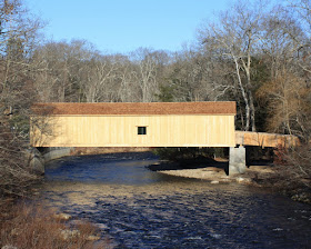
Comstock Covered Bridge, East Hampton-Colchester, CT

January, 2012
The Comstock Bridge, or the Comstock Covered Bridge or simply just "Covered Bridge" bridges the Salmon River and connects East Hampton and Colchester. It is one of Connecticut's three remaining covered bridges -- the other two being the Bulls Bridge in Kent and the Covered Bridge in West Cornwall.

Increasingly desperate measures were necessary to keep the bridge from falling into the river. A few years back, massive metal beams were bolted to the sides of the bridge, but that only delayed the inevitable. The state chose to rebuild the bridge, using as much of the wood from the original bridge as they could. Construction is nearly done and should be fully complete in February, 2012.

Ryan Blessing of the Norwich Bulletin writes:
The 90-foot bridge over the Salmon River and north of Route 16 was closed in March of 2009 so work could begin on the $1.1 million project, according to the state Department of Transportation. It is one of only three covered bridges remaining in Connecticut, the DOT said. “It’s a very unique and historical bridge,” DOT spokesman Kevin Nursick said. “There’s been a bridge at that spot since the 1700s.”
I first visited the Comstock Bridge at the beginning of October and was a little surprised (and a little disappointed) to find the bridge mostly taken apart.

October, 2011
I'd heard that Hurricane Irene had torn out some bridges and assumed (wrongly) that the Comstock Bridge had been one of her victims.

Turns out it was entirely intentional. I'd really wanted to visit the bridge; in fact I really wanted to ride my bike down to Colchester and cross that bridge.

No luck.

There's just not a lot of information about the bridge construction easily available online. I did some digging in the Connecticut Department of Transportaton's website, and finally had some answers. It was being rebuilt. Construction would be finished by the end of November, 2011.

(Oh, here's an article on nearby East Haddam's website about the reconstruction of the bridge).

November, 2011
I duly returned to the bridge in late November, hoping to take a walk over it, but it still wasn't done. There had been a lot of progress. The beam and truss frame was up and the roof was beginning to come together.

The foliage was beautiful. Next year, the finished bridge is going to be a perfect picture.

There are a lot of great places from which to photograph this bridge. Route 16 runs right past the bridge. Park in the parking lot just as you turn from Route 16 onto Comstock Bridge Road, then walk back up Route 16 to where it crosses the Salmon River, look upstream and take the shot (the first shot was taken from this point). If you walk up Comstock Bridge Road a little, you can hop over the guardrail and head upriver to get a great shot looking back at the bridge -- the third picture was done from here.

There's a trail used by fishermen on the Colchester side of the bridge that gives great views of the bridge (and beneath) for awhile before a bend in the river hides the bridge (second picture was from this vantage point).

The annual Salmon River 5.5 Mile Run starts and finishes at the Comstock Bridge. I might just have to run in it this year.

Steve of CTMuseamQuest.com seems to have dug up pretty much everything there is to know about the bridge as of 2007, before they started dismantling it. By the time I heard of the bridge, it was already being re-assembled. There's luck for you. I went down to Colchester lured by the pictures on Google Street View and was surprised to see just beams and part of a floor. I'd have been utterly shocked if it weren't there at all.